
After Tenerife, the island of Gran Canaria is the second Canary Island we have travelled to this year. We spend nine days to explore the most famous sights and photo spots such as the impressive dune landscape of Maspalomas, the capital Las Palmas or the Aquarium Poema del Mar. Here you will find our Top 15 sights of Gran Canaria that you should definitely see when visiting the island.
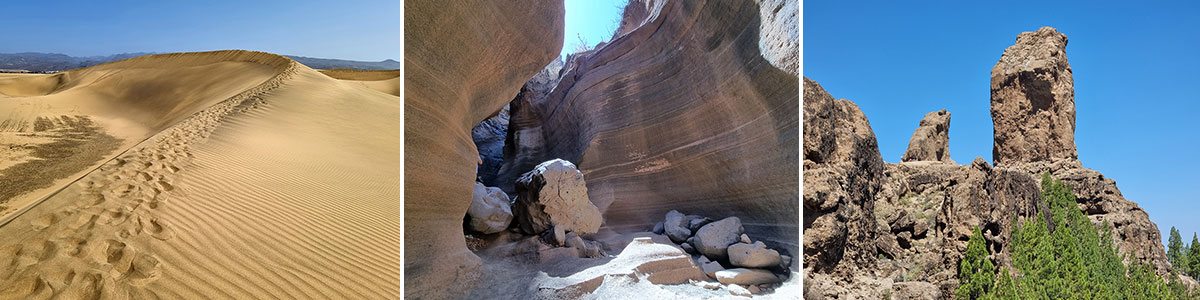
Table of contents
Things to know about Gran Canaria
With an area of 1560.1 km², Gran Canaria is the third largest of the Canary Islands after Tenerife and Fuerteventura. With its approximately 855,000 inhabitants, it is even the second largest island in the Canary Islands in terms of population after Tenerife. The island in the Atlantic Ocean has a south-north and west-east extension of about 50 kilometers and a coastline of about 236 kilometers. Since Gran Canaria is only about 210 kilometers west of the coast of Morocco, it belongs geographically to Africa, but politically to Spain.
Gran Canaria is an absolute tourist magnet: every year about 2.8 million holidaymakers – mainly from Central and Northern European countries – visit the island. They are mainly accommodated in the tourist centers around Maspalomas, Playa del Inglés and San Agustin. As an “island of eternal spring”, it impresses with year-round mild temperatures between 18 and 26 degrees.
The island of Gran Canaria
Our top 15 sights & places in Gran Canaria
We had chosen a hotel in the south of the island for our holiday in Gran Canaria. Hotel Bull Eugenia Victoria is located right in the resort of Playa del Ingles. Directly at the hotel is the rental station of Cars Victoria Rent a Car. Despite high season and scarce car stocks, we got a rental car for 3 days (Renault Clio) and 40 Euros per day incl. of all insurances. With it we could jet over the island to see the most beautiful sights and photo spots.
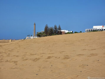
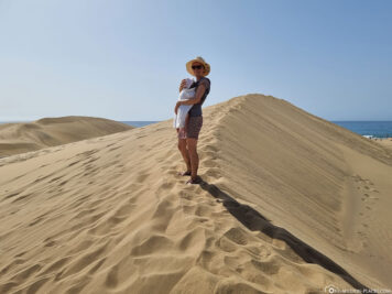
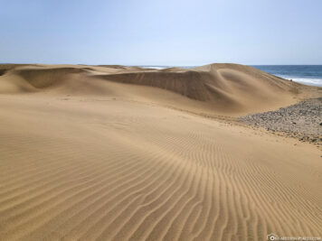
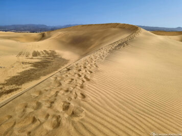
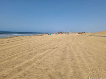
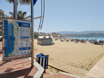
The Maspalomas Dunes
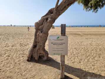
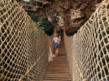
The sand dunes of Maspalomas are definitely THE highlight of Gran Canaria and absolutely worth a visit. From our hotel we used the free beach shuttle that took us to Playa de Maspalomas. From there we walked along the beach to Playa del Inglés, climbed some sand dunes and took countless photos. On some websites we had read in advance that you can no longer walk cross-country over the dunes, but can only discover them via a closed path. Therefore, we were (positively) surprised on site, because we did not see anything of barriers far and wide, so that we could move freely.
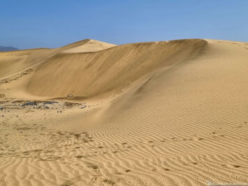
The shifting dunes of Maspalomas are a nature reserve designated by the Canarian government and extend over a length of six and a width of one to two kilometers. For a long time, it was unclear how or by what this natural phenomenon arose. Now it has been scientifically proven that the sand comes from the sea directly off Gran Canaria and consists mainly of crushed coral and shell limestone washed up by the surf. The trade wind transports the sand inland until it settles on the first obstacle. This is how dunes are created and grow. Even though we have seen such a dune landscape in Australia and Dubai before, we were very enthusiastic about the sand dunes in Maspalomas.

The capital Las Palmas de Gran Canaria
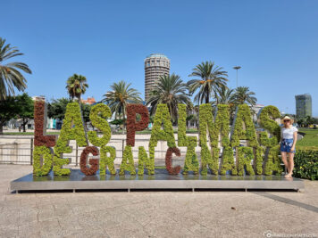
From Playa del Inglés we took bus number 30 (see bus route on Moovit) directly to the capital of Grand Canaria, Las Palmas. The fare is 6.20 euros per person one-way and we were just over an hour to the bus station of the Santa Catalina district. Las Palmas de Gran Canaria is the largest city in the Canary Islands with almost 380,000 inhabitants. In addition to Santa Cruz de Tenerife, it is one of the two capitals of the Canary Islands.
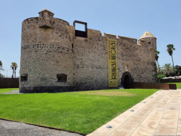
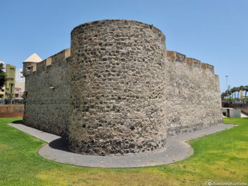
At the Plaza de Canarias the first highlight was waiting for us. Here is a very nice green planted lettering with the name of the capital. Definitely a cool photo opportunity! After our visit to the Aquarium Poema del Mar (see next point) we visited the Castillo de la Luz in the north of the city. The former fortress from the 16th century used to be located directly on the sea and served as a defensive structure against attacks from the sea side – for example by pirates. Today, the castle is home to a maritime museum and changing art exhibitions.
Just a few minutes walk from the castle, you can reach Playa de Las Canteras. This is a 3.2 kilometer long sandy beach, which extends over the whole bay and is said to be one of the most beautiful city beaches in the country. We just walked a bit along the beach promenade and watched the hustle and bustle around us.
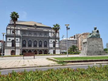
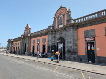
From the beach we drove to the next bus stop and drove towards the old town. Fittingly, the bus stopped directly at the Mercado de Vegueta market hall, but since it was unfortunately already afternoon, it had already closed. A pity, because we like to stroll through markets and through market halls and always find it exciting what is offered there. Directly opposite the market hall is the Teatro Pérez Galdós on the other side of the street, which we liked very much visually from the outside. It is the most important theatre in the city and, after a major renovation in 2007, is considered one of the most modern theatres in Spain.
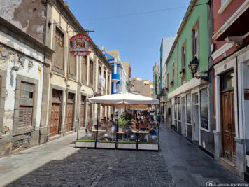
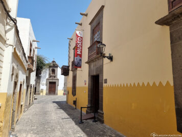
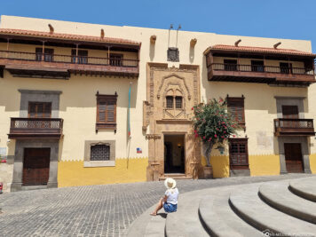
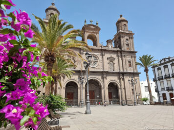
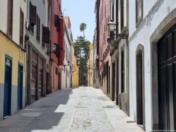
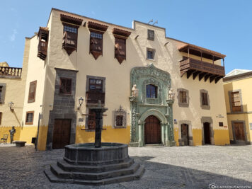
From the market hall and theatre, it is only a stone’s throw to the old town of Las Palmas, which in 2007 was placed on the national list of proposals for inclusion as a UNESCO World Heritage Site. The highlight in the old town is the five-aisled Cathedral of Santa Ana from 1497, which is located with the old town hall on the main square, as well as the Casa de Colón,an impressive colonial building that houses the Columbus Museum. In 13 exhibition rooms you can learn more about Columbus, his travels, the Canary Islands and the history and development of the city of Las Palmas. If you stand in front of the main entrance of the museum, a short walk to the right of the building is worthwhile, because there is another beautiful building façade and a fountain. During our walk through the old town, we also passed the Museo Canario, which houses a valuable collection of archaeological finds from the Canary Islands.
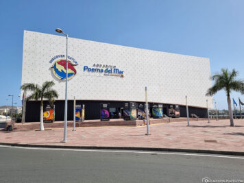
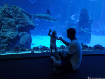
The Aquarium Poema del Mar
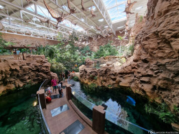
The Aquarium Poema del Mar (“Poem of the Sea”) is one of the most modern aquariums in Europe with an area of 12,500 m² and more than 400 species and offers a journey through the ecosystems and marine worlds of the entire planet. It is located directly on the port of Las Palmas, at the Sanapú pier, 200 meters away from the popular city beach Las Canteras and the Santa Calina Park. Due to its central location, it is also an ideal destination for cruise guests in Gran Canaria, as the aquarium is only 400 meters from the cruise terminal. The opening hours are Monday to Sunday from 9.30 a.m. to 5.30 p.m. The entrance fee is 25 EUR for adults and 17.50 EUR for children. Children under the age of 3 are admitted free of charge.
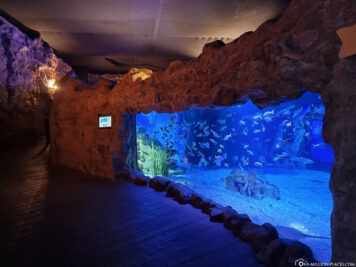
The tour of the aquarium is divided into three different exciting areas: the marine ecosystem in the reef, life in the deep ocean and fresh water. In these different environments, the natural ecosystems of hundreds of species have been recreated with the greatest possible accuracy.
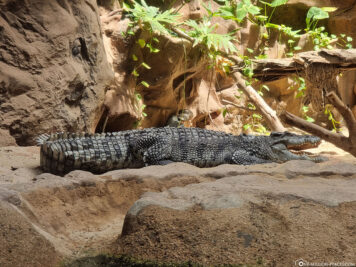
After the entrance, you first enter the “Jungle” theme area through a palm and rock backdrop. The huge hall, modeled after rainforests and other biotopes from all over the world, is home to various reptiles, amphibians and aquariums with freshwater fish. Animals in the jungle include giant snails, frogs, chameleons, scorpions, lizards and even crocodiles.


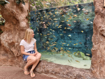
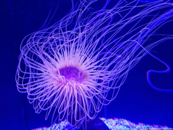
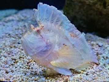
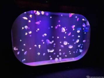
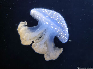
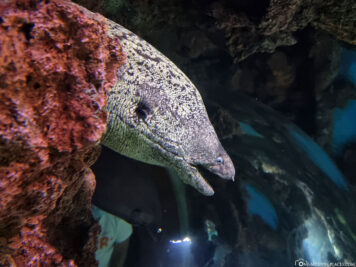
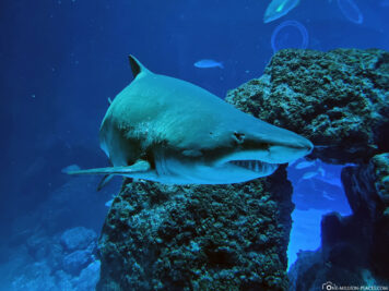
After the jungle you get into the underwater world of the reefs. The cylindrical reef basin, which holds 400,000 liters of water, shows the colorful diversity of a coral reef. Among the most famous sea creatures in the aquarium are: seahorses, axolotls, angelfish, wrasses, blue-spotted rays, mackerel, puffer fish, clownfish, doctor fish, lionfish, octopus, eagle rays, dragonhead fish, moray eel, mandarin fish, jellyfish, Picasso triggerfish, piranhas and hawksbill turtles. But also different shark species can be admired here: nurse sharks, bull sharks, bamboo sharks, reef sharks, bullhead sharks, sand tiger sharks, sutchi sharks and zebra sharks.
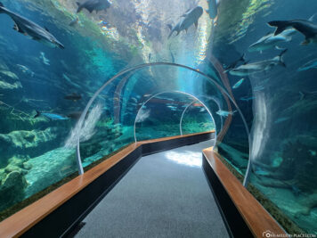
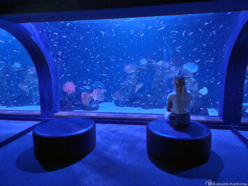
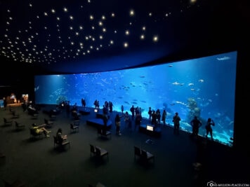
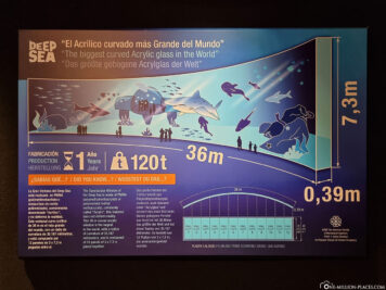
The highlight is the large aquarium which gives insights into the fascinating underwater world of the deep sea like a gigantic screen. The large curved acrylic window is the largest in the world at 36 meters. It consists of 12 plates of 3 meters by 7.30 meters, glued together and weighing 120 tons. The basin holds a total volume of more than 5.5 million liters of water and is mainly home to the large sea creatures such as stingrays, tuna and sharks.
Overall, the visit to the Aquarium Poema del Mar is one of the most beautiful sights in Gran Canaria for us. We spent a total of 2 hours here and are always amazed by the fascinating underwater world. By the way, the aquarium belongs to the world-famous Loro Park in Puerto de la Cruz on Tenerife, which we have already visited this year 🙂
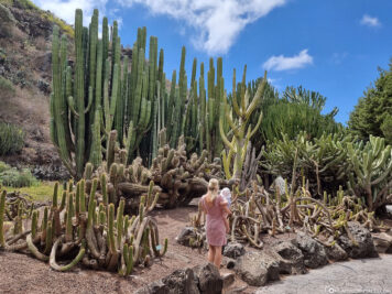
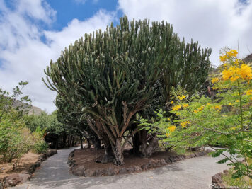
The Jardin Canario Botanical Garden
About 7 kilometers southwest of the capital Las Palmas is the botanical garden of the island: Jardín Botánico Canario Viera y Clavijo. Admission is free and there is plenty of free parking in front of the lower main entrance. The garden is open from 7.30 am to 2 pm on weekdays and from 10 am to 5 pm on weekends.
At the entrance there is an overview map, on which you get a good overview of the approximately 27 hectares of land. Since we only had about an hour until the closure, we could only visit a small part of the garden. We particularly liked the area of cacti and succulents, because there were some really huge specimens.
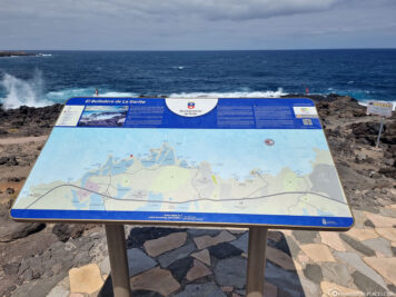
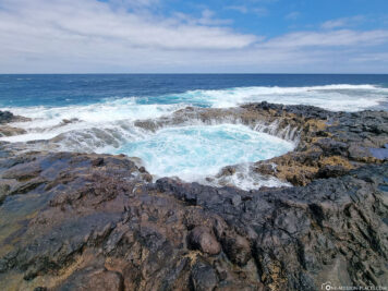
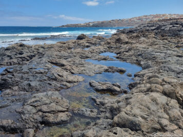
The waterhole El Bufadero de la Garita
We love to watch natural spectacles, so we were already very excited about the waterhole El Bufadero de la Garita, which is located in the east of the island not far from the GC-1 motorway. Free parking is available on site and the waterhole is freely accessible at all times.
Unfortunately, the waterhole did not impress us terribly, because we may have had different expectations due to the pictures on the Internet. In principle, the water pushes (at sufficient tide) from the Atlantic and pushes over the edge of the rock into the waterhole. This creates a small waterfall at the edge of the hole all around, which has not really shown itself with us.
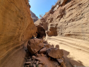
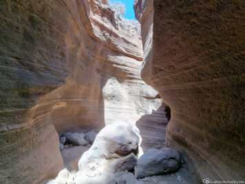
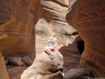
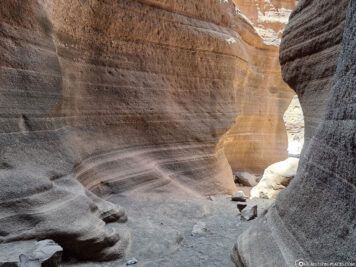
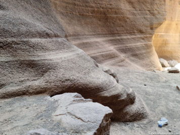
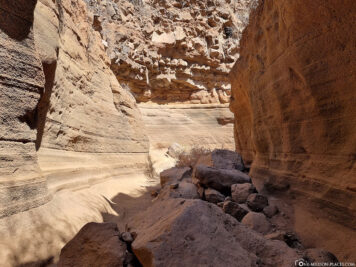
The Barranco de Las Vacas Gorge
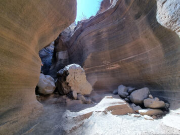
One of our absolute highlights in Gran Canaria is the somewhat hidden gorge Barranco de Las Vaca. It is located about 4 kilometers west of the village of Agüimes on the GC-550 road. To get there, simply enter “Tobas de Colores Barranco de Las Vacas” on Google Maps. Five to six free parking spaces are available about 500 meters down the street, from there it is about 15 minutes on foot. Either you walk directly along the road and climb down the stone bridge into the gorge or you go down into the gorge just after the gravel parking lot and then walk under the bridge. From the stone bridge it is only a few meters until you have reached your destination.
What awaited us there reminded us directly of Antelope Canyon in Arizona, which is still very high on our bucket list. The canyon in Gran Canaria, like the Antelope Canyon, was formed over hundreds of years by the power of water, which literally “eats” its way through the rocks and sandstone. The canyon is certainly no longer an insider tip, because when we were there in the late afternoon, there were still about 10 other people there. But a visit is definitely worth it! For us it was the most extraordinary and beautiful photo and Instagram spot in Gran Canaria.
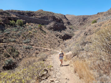
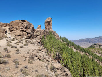
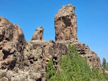
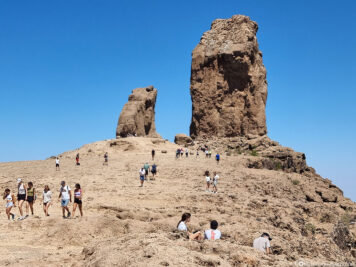
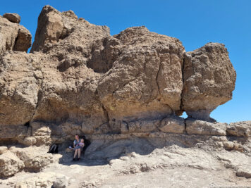
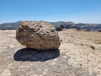
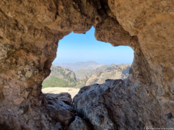
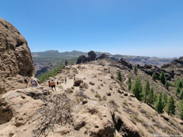
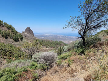
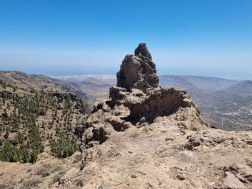
The Roque Nublo
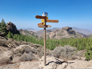
In the center of Gran Canaria is the mountain Roque Nublo. It is best known for its eye-catching 65-metre-high basalt rock of the same name, which stretches into the sky at an altitude of 1,813 metres, making it the third highest elevation on the island. The summit rock is one of the landmarks of Gran Canaria and a popular excursion and hiking destination.
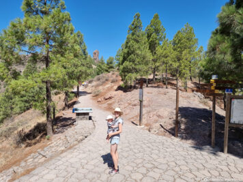
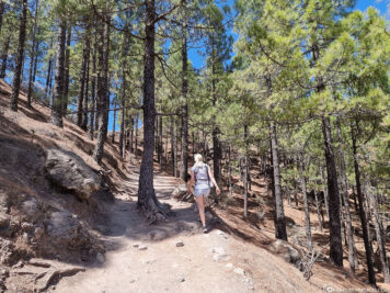
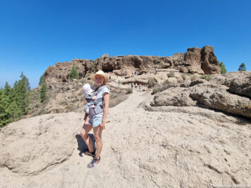
When we arrived at the top of the parking lot at noon, it was already completely full. The roadsides were also already parked. So we just stood in the parking lot and waited for someone to return from their hike. And lo and behold, it didn’t take 5 minutes for someone to drive away with their car. There is actually a lot of coming and going there, so it is worth waiting for a short time for a free gap. At the parking lot, which by the way is at an altitude of 1,581 meters, there is still a small stall where you can buy chilled drinks, freshly squeezed orange juice and snacks.
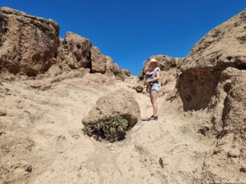
With our little mouse in the stretcher we started in the midday heat towards the summit. We can definitely confirm that the hiking trail is popular, because people kept coming towards us or overtaking us. For the 2 kilometer long hiking trail we needed about 30 minutes. At first it goes through a small shady forest, later it becomes steeper and a bit more uneven. Nevertheless, it is a relatively easy hike where you will be rewarded with fantastic views at the end.
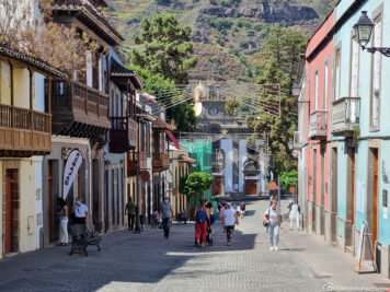
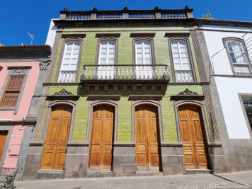
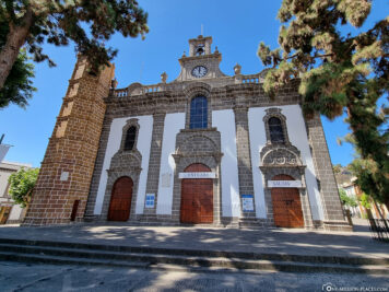
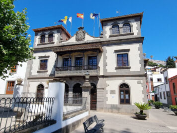
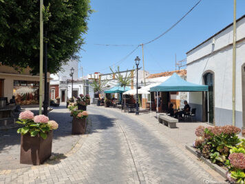
The city of Teror
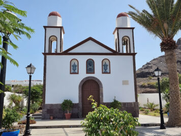
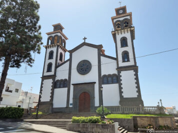
In the north of the island, about 20 km from the capital Las Palmas, is the small village of Teror. We parked our rental car on a free gravel parking lot on the edge of the city center and were able to explore the old town on foot from there. The old town, which was completely listed in 1979, is not particularly large, but still quite pretty: Here are many pretty houses partly from the 16th century; most with typical Canarian wooden balconies. The main attraction in Teror is the Basilica “Nuestra Señora del Pino” which was built in Baroque and Neoclassical style. The original building dates back to 1767; however, the church was destroyed and restored several times. The village is also known as a place of pilgrimage, because at the beginning of the 20th century the Holy Virgin “Virgen del Pino” was elevated to the patron saint of the island by the then Pope.
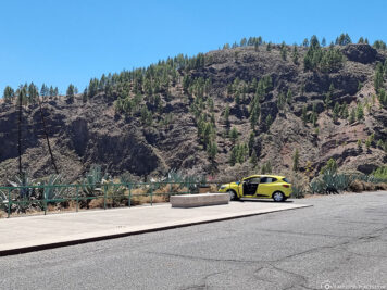
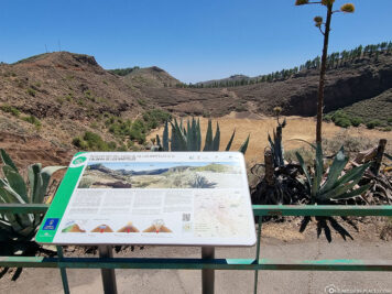
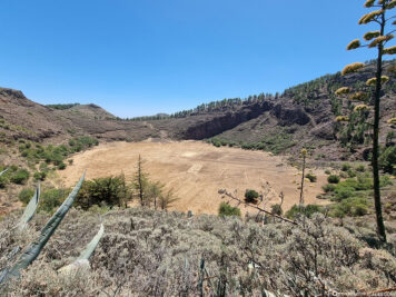
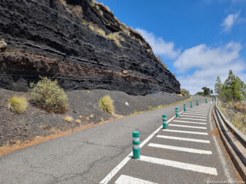
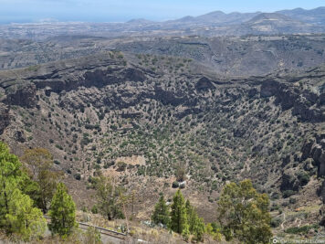
The Caldera de Los Marteles
During our exploration we discovered in the heart of the island a beautiful viewpoint of the Caldera de Los Marteles, which was formed less than 1 million years ago. The volcanic cauldron, which is about 80 meters deep and 550 meters wide, was formed by a volcanic eruption in which magma came into contact with underground water. At the bottom of the cauldron you can see geometrically landscaped fields that used to be used by farmers for agriculture and livestock farming. There are some hiking trails in this area, also along the volcanic cauldron.
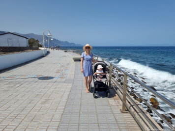
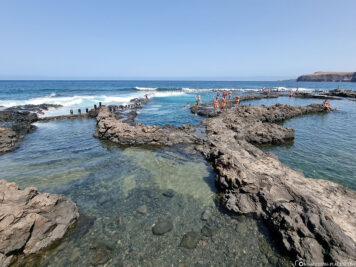
The town of Puerto de Las Nieves
In the northwest of the island is the small coastal town of Puerto de Las Nieves. We have parked our rental car for a daily flat rate of 2 EUR in a parking lot (Google Maps: “Parking Piscinas Naturales Las Salinas”). From here it was a stone’s throw to the “Agaete Piscina Natural” – natural swimming pools directly on the ocean, which are accessible free of charge. We then walked along the promenade path to the harbour. From here, the private shipping company Fred. Olsen Express a regular ferry service to Tenerife. At the port there is the city beach “Playa de las Nieves”, which was incredibly crowded. No wonder, because especially on weekends, the place is a popular destination for locals. From the pier you have a beautiful view of the landmark of the coastal town, the rock formation Dedo de Dios. Unfortunately, the so-called “finger of God” is no longer one, because the rock needle cut by wind and weather broke off in 2005 during a tropical storm.
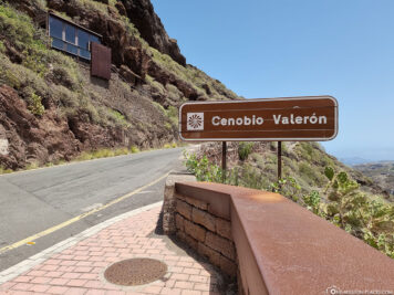
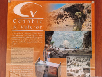
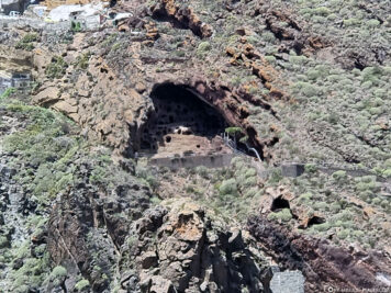
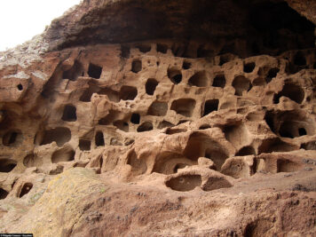
The Cenobio de Valerón
Unfortunately, we could not visit the archaeological site Cenobio de Valerón as it is temporarily completely closed. This is an old granary of the first known inhabitants of Gran Canaria, who used it until the Spanish conquest of the island in the 15th century. The granary comprises a total of 298 chambers on eight floors, which were dug into the soft volcanic rock. The storage caves have different shapes and are between one and three square meters in size.
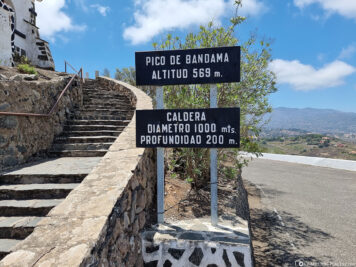
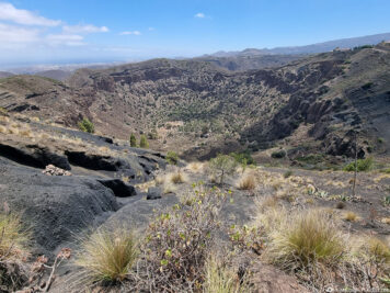
The Pico de Bandama
A beautiful viewing platform is located on the 569-meter-high peak Pico de Bandama which is accessible via a paved serpentine road. From here you have a wonderful view of the Canarian mountains and the crater basin to the south, which has a diameter of about 1,000 meters and a depth of 200 meters. There is even a hiking trail down into the caldera, which is supposed to be very strenuous – especially on the ascent.
The mountain town of Moya
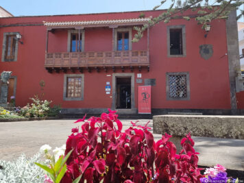
Moya is a small mountain town in the north of Gran Canaria, through which we took a short walk. The main attraction of the village is the church of Nuestra Señora de la Candelaria, inaugurated in 1957, which was built directly on the steep slopes above the gorge of Moya. Opposite the church is the red-colored birthplace of the poet Tomás Morales, who was born in Moya in 1884. Today, the house houses a museum with an extensive collection of his work, but also a library and a collection of painters.

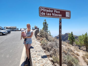
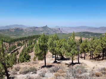
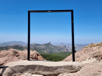
The Pico de Las Nieves
One of the most beautiful viewpoints of the island is located on the Pico de Las Nieves, which is the second highest elevation of Gran Canaria with a height of 1,949 meters. From here you have a great view of the surrounding mountainous landscape and even see the Roque Nublo in the distance. On the viewing platform there is a food truck and directly behind it it goes up a bit higher. This should not be missed, because from here you have a beautiful view to the sea and to the Morro de la Agujereada with an altitude of 1,956 meters the highest mountain of Gran Canaria.
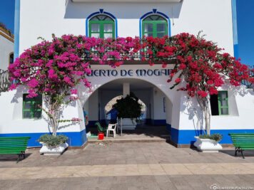
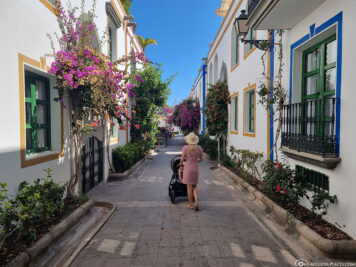
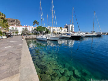
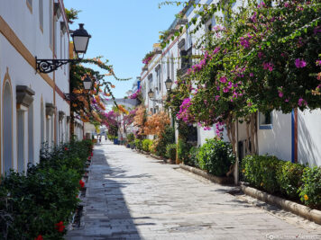
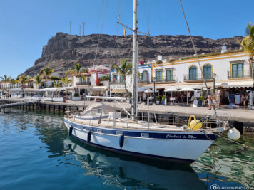
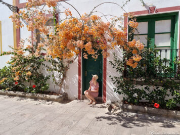
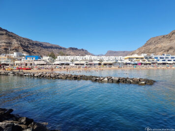
The coastal town of Puerto de Mogán
The port town of Puerto de Mogán is located on the south coast of Gran Canaria. We parked our rental car directly near the harbor, so that we could stroll relaxed through the small picturesque alleys. The place was founded in the 1980s and is – due to some canals – also called “Little Venice”. We really liked the architecture around the harbor: white, two-story houses with colorful color highlights as well as green doors and windows. In between, many climbing flowers, palm trees on the promenade and crystal clear water in the harbor basin. A great place to stay!
A map with all the sights on the island
On the following map at Google MyMaps we have marked all the important sights and photo spots on the island of Gran Canaria.
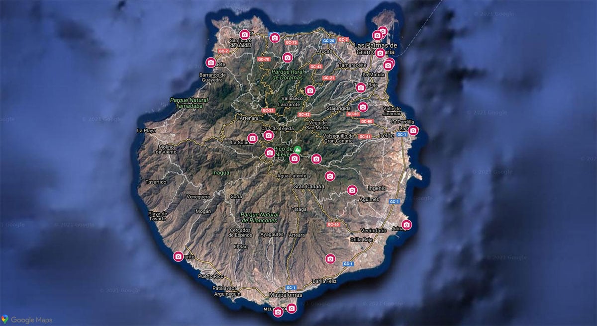
A Google MyMaps map with all the main attractions in Gran Canaria
In total we spent 9 wonderful days in Gran Canaria. If we have forgotten an interesting sight in our travel report, please write it to us in the comments below. We would be very happy.