
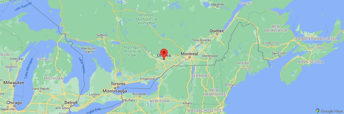
After driving the 670-kilometer route from Tadoussac over the Omega Parc to Ottawa the day before, today we visited the Canadian capital. Ottawa is located in the southeast of the province of Ontario, right on the border with the province of Québec. The location on the Ottawa River and Rideau Canal together with Parliament Hill forms a beautiful and very worth seeing city backdrop.
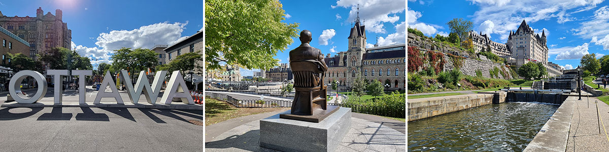
Table of contents
Things to know about Ottawa
Ottawa has been the capital of Canada since 1857. At the time, Ottawa was a village, secluded timber hut settlement, but had a thriving timber industry and was geographically and strategically very well positioned due to its location on the river. Today, Ottawa has a population of about 1 million; This makes it the sixth largest city in Canada. Together with the adjacent sister city of Gatineau, more than 1.3 million people live in the Ottawa-Gatineau metropolitan area.
Unlike the adjacent French-speaking province of Québec, Ottawa’s population is 63% English-speaking and 15% French-speaking. This makes it the only officially bilingual city in the region. Ottawa’s economy is supported on the one hand by the large number of federal agencies and the seat of the federal government, on the other hand there are also many jobs in the high-tech industry.
The location of the capital Ottawa in Canada
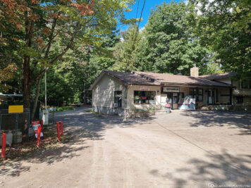
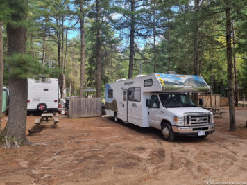
Our campsite Ange-Gardien
We actually struggled a bit to find a suitable campground in Ottawa that isn’t that far from the city. Somehow the selection was not so big now. We chose Camping Ange Gardien which is over 30 kilometres from downtown Ottawa. The pitches here are located in a shady pine forest and have no connections up to full connections (electricity, water, sewage), which are suitable for all types and sizes of motorhomes or tents. In itself, the campsite is very well equipped with Wi-Fi at every pitch (which sometimes worked well, sometimes badly), a pool, a small grocery store and a restaurant.
From the campsite we took a taxi to Jacques Cartier Park for 53 CAD (= 37 EUR), which is located in Gatineau – opposite Ottawa. In the afternoon we drove from downtown Ottawa with an UBER back to the campsite for just 37 CAD (= 26 EUR).


The sights of Ottawa
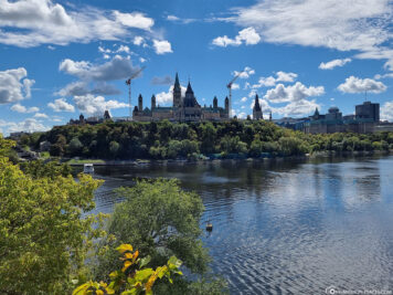
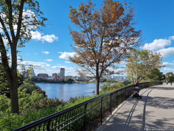
We started our city tour on the Gatineau side, from there we were able to enjoy a magnificent view of Parliament Hill and the city of Ottawa and then walked over the Alexandra Bridge into the city, where some more worth seeing photo spots and sights were waiting for us. The city center is quite compact, so you can easily explore all the sights on foot and on your own in one day.
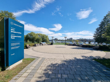
Jacques Cartier Park
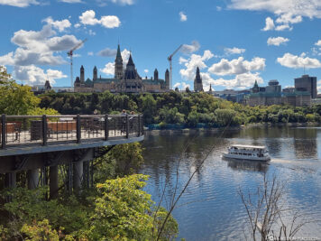
The Jacques Cartier Park in Gatineau, i.e. directly opposite Ottawa, was on our sightseeing list because we saw on the Internet quite great pictures of plant figures that are supposed to be in the park. Unfortunately, we searched in vain for them. A little more detailed research in the aftermath has shown that these plant figures are only available as part of the annual Mosaïcultures Festival. The next Mosaïcultures will take place for the first time in Québec City from 24.06.2022 to 10.10.2022 – with 200 plant sculptures consisting of more than 6 million plants. Wow, we really would have liked to see that!
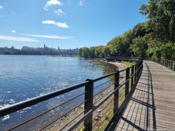
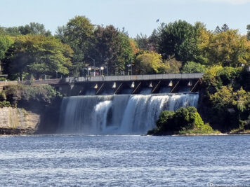
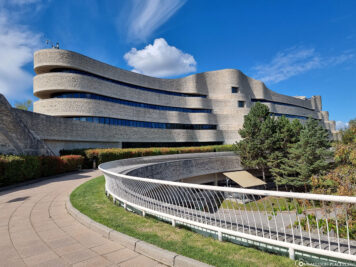
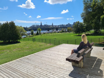
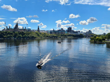
From Jacques Cartier Park you have a beautiful view of the opposite Ottawa and even the Rideau waterfall. It is best to walk a little south along the Voyageurs Pathway, which runs directly in front of the National Museum of History. From there, the view of Parliament Hill is just great!
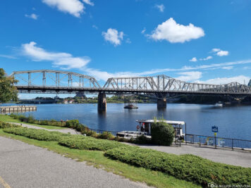
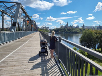
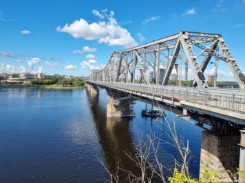
A walk across Alexandra Bridge
The best way to get from Gatineau to Ottawa on foot is to cross the 563-meter Alexandra Bridge. On the one hand, the bridge is quite impressive to look at and on the other hand you have a magnificent view of the skyline of Ottawa-Gatineau, the Ottawa River and the Parliament buildings from here.
The Alexandra Bridge was built between 1898 and 1900 by the Canadian Pacific Railway as a pure railway bridge. In the late 1950s, the bridge was rebuilt for vehicle and pedestrian traffic. With the closure of Ottawa Union Station in 1966, the last passenger trains ran across Alexandra Bridge and the railroad tracks were removed. Since then, the bridge has been used exclusively for pedestrian and vehicle traffic.
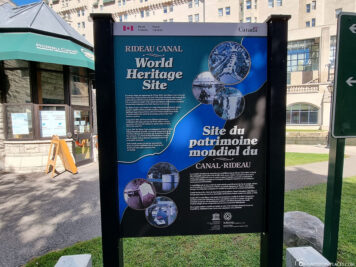
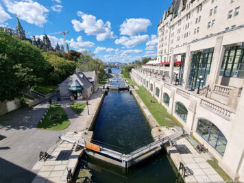
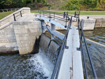
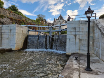
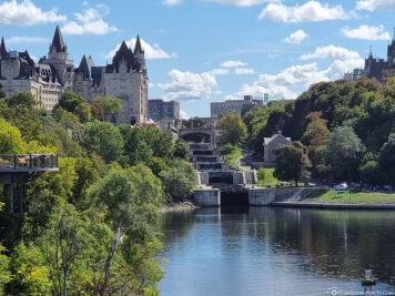
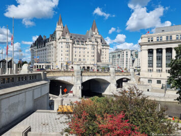
Rideau Canal & Ottawa Locks – a UNESCO World Heritage Site
After crossing the Alexandra Bridge, we first walked to the Rideau Canal which has been a UNESCO World Heritage Site since 2007. The 202-kilometer Rideau Canal connects Ottawa with the city of Kingston on Lake Ontario. Opened in 1832, it is the oldest continuously used artificial waterway in North America. Originally, the canal was used for military purposes and was intended to provide a secure supply and communication route.
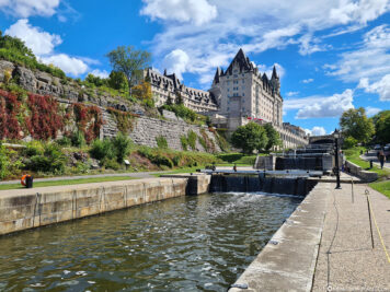
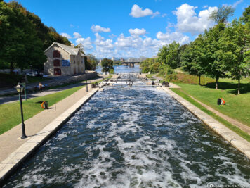
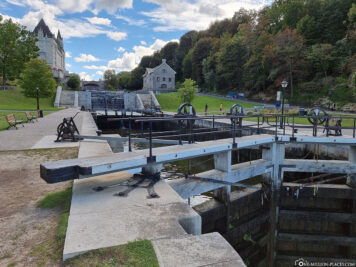
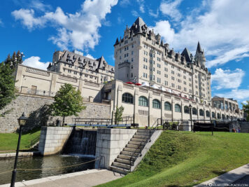
Very worth seeing are the Ottawa Locks, which are located right next to the luxury hotel Fairmont Chateau Laurier. The Ottawa Locks are 8 locks that overcome a height difference of 24 meters. The Rideau Canal empties into the Ottawa River at this point. We think it’s really cool that the frozen canal is converted into an ice skating surface in winter. The 6.4-kilometre section in downtown Ottawa will become the world’s largest skating facility.
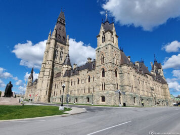
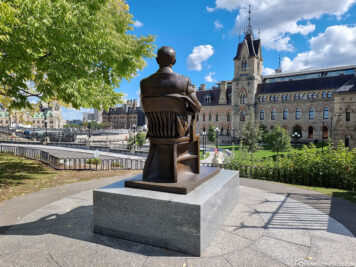
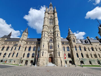
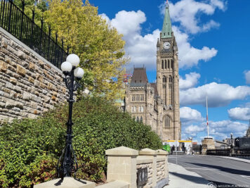
Parliament Hill
On Parliament Hill, which lies on the south bank of the Ottawa River, the buildings of the Canadian Parliament are located on an area of 88,480 m². Once there was a military barracks here. When Queen Victoria declared Ottawa the capital of Canada in 1859, the conversion to a government district began.
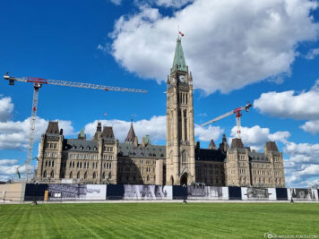
The most striking building on Parliament Hill is the Centre Block with the 92-metre-high Peace Tower, which somehow totally reminded us of London’s Big Ben. Currently, extensive reconstruction work is taking place on Parliament Hill, so that you can see many cranes, construction fences and excavators here. Due to the corona pandemic, there are currently no guided tours in the Canadian Parliament. We thought that was a pity, because we would have liked to have taken a look into the buildings. It is best to inform yourself in advance on the official website when guided tours are possible again. These can then also be booked there directly.
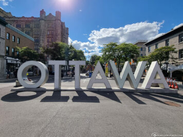
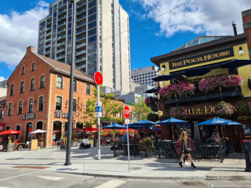
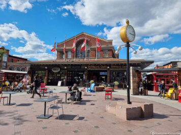
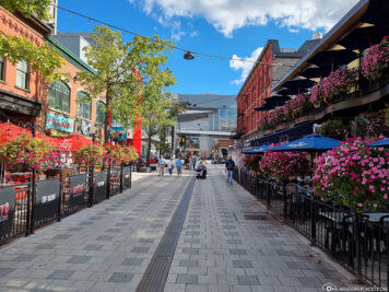
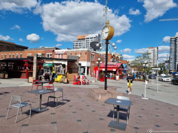
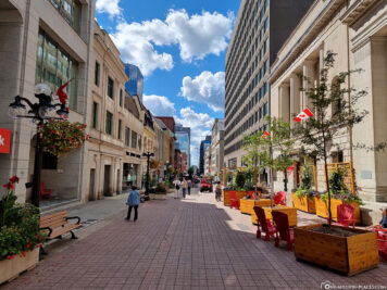
ByWard Market District
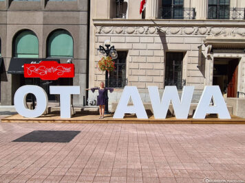
The trendy district ByWard Market was the last stop of our city tour. A lot of restaurants & cafés, shops as well as numerous art and cultural institutions have settled here. In addition, you will find a large “OTTAWA” lettering here.
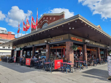
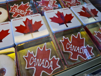
In the ByWard Market you will also find the small café Le Moulin de Provence, which offers a very special treat: the so-called “Obama Cookies”. Where does this name come from? On February 19, 2009, then-U.S. President Barack Obama visited the city of Ottawa and made a brief stop at this café to buy a cookie. The delicious butter biscuits in the shape of a maple leaf with the frosting lettering “Canada” represent a new era in relations between the USA and Canada. With the exclamation “I love this country!” Obama warmed the hearts of all Canadians on this cold February afternoon during his historic visit to Ottawa.

More Sights & Photo spots
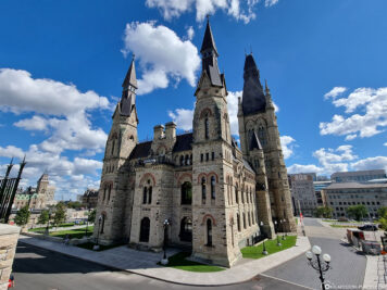
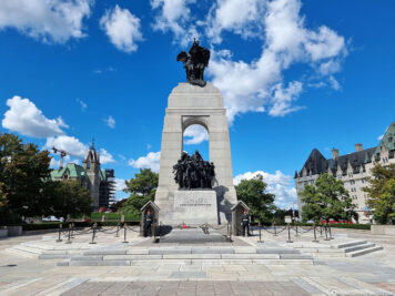
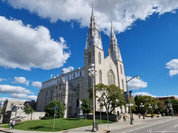
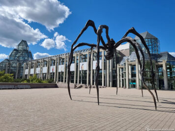
On our walk through Ottawa we were able to discover many more beautiful photo spots and sights. For example, there is a huge spider in front of the National Gallery of Canada : the Maman statue is over 9 meters high and carries a bag with 26 marble eggs. A truly extraordinary photo motif 😉 Directly opposite is the Cathedral Basilica Notre Dame , the oldest church in Ottawa. We particularly noticed the two spires, which are covered with silver-colored metal. This is probably typical for Eastern Canada and we have already seen it in another church.
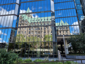
Just like Québec City, Ottawa also has a luxury hotel from the Fairmont hotel chain. Château Laurier looks like a castle from the outside, but is actually a hotel. It is perfectly located, because from here you can reach all the main attractions of Ottawa in a short time. An overnight stay is available with Booking.com from about 180 EUR.
A map with all the sights in Ottawa
On the following Google MyMaps we have drawn the most important sights and photo spots in Ottawa. Certainly, in addition to these points, there are many other interesting places and sights. If we have forgotten something special, please write it to us in the comments below, we will gladly take the point with us on the map 🙂
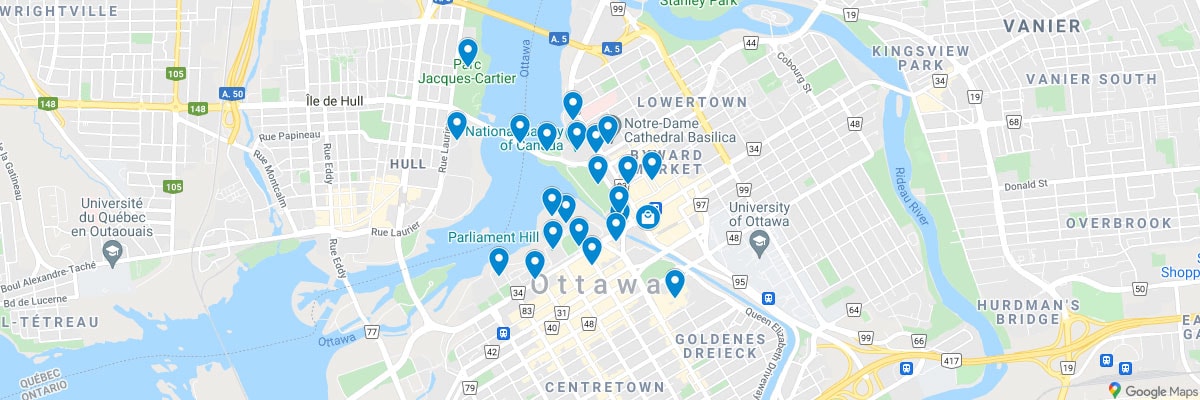
A map with all the sights in Ottawa (Canada)
All travel reports from our camper round trip through Canada
Vacation with the camper or motor home in Canada - for many probably quite normal, but for us it was actually the first time. We have never been on the road with a camper, but always wanted to try it. In total, we drove almost 3,300 kilometers with our camper and explored beautiful regions and cities in eastern Canada.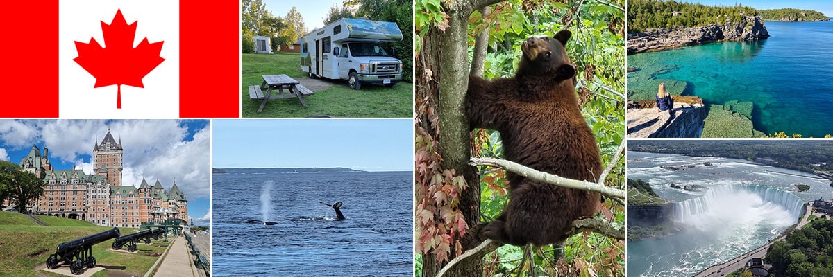 » Our Holiday in Canada 2021 - Flight, Entry & Itinerary
» Camping in Canada - Our Questions, Experiences & Tips
» La Mauricie National Park - A hike on the Les Cascades Trail
» Québec City - Things to do, Sights & Photo Spots
» Canyon Sainte-Anne - Waterfalls, Cascades & Suspension Bridges
» Tadoussac - Whale watching on the Saint Lawrence River
» Parc Omega - Drive-Through Safari in Quebec
» Ottawa - The capital city of Canada
» Algonquin Provincial Park - Lakes, forests and magnificent viewpoints
» Bruce Peninsula National Park - Dreamlike bays at Lake Huron
» Niagara Falls - The largest waterfalls in North America
» Toronto - Things to do, Sights & Photo Spots
» Thousand-Islands National Park - 1.864 Islands in the Saint Lawrence River
» Montreal - Things to do, Sights & Photo Spots