
We love to explore a region, an island or even a city completely on your own. This allows us to choose our own pace relatively independently and plan the day in the way that suits us best. Long Island in the Bahamas is perfect for exploring with a rental car. In addition to its white beaches and crystal clear waters, the island has much more to offer 🙂
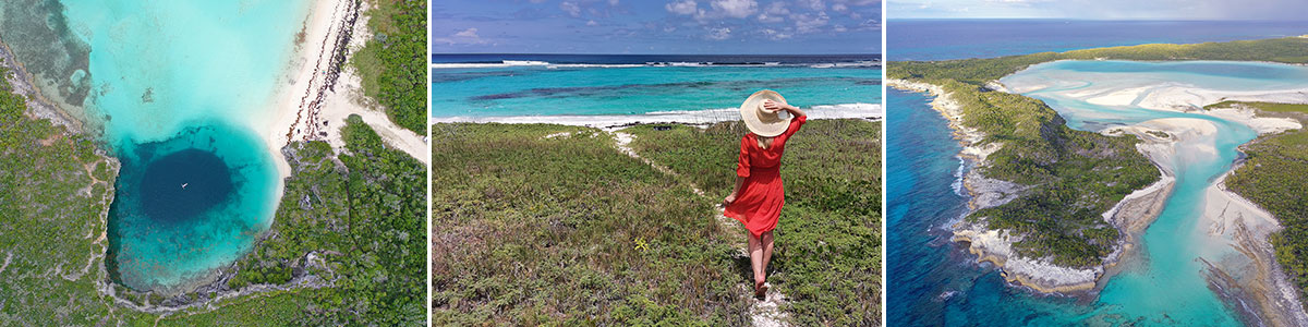
Table of contents
Things to know about Long Island in the Bahamas
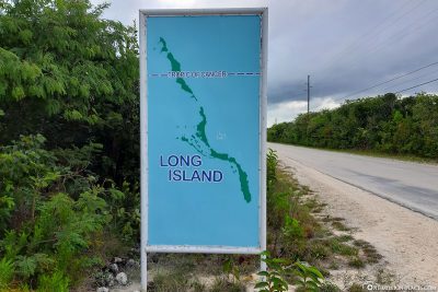
Long Island is one of more than 700 islands in the Bahamas and is located about 265 km southeast of the capital Nassau. The island is 130 kilometres long and up to 6 kilometres wide, and thus lives up to its name. When Christopher Columbus passed here in 1492 on his way to America, he gave the island the name Fernandina – in reference to the former Sicilian King Ferdinand II. The island was given its current name by sailors who chose Long Island because of the long-lasting redevelopment of the island.
Today, the island is home to about 3,000 people and about 3 to 4 times as many tourists visit the island every year. By comparison, Nassau has to cope with this number of visitors in one day when several large cruise ships dock. This also means that Long Island is not yet so far accessible for tourism and is therefore perfect for a relaxing holiday.
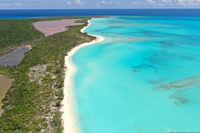
The island runs from Seymour’s in the north to Gordon’s in the south, the only main road, the Queen’s Highway, which connects about 35 settlements, often made up of only a handful of houses. The highway divides the island in two halves: the side facing the Atlantic is characterized by cliffs that fall steeply into the sea, while the Caribbean side with its white sandy beaches and turquoise waters rises. The coasts could not be more opposite.
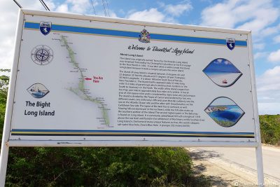
A map with all sights
On the following Google MyMaps map we have mapped all the important sights on the island. You can download a large map of Long Island here as .pdf.
Our tour of the island
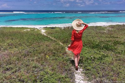
We had planned a day for exploring the island to visit the most important points of the island in peace and in a very individual way. Because Long Island has a lot to offer: from dreamy sandy beaches, to turquoise-blue bays, deep holes in the sea to an exciting cave system.
Car Rentals & Supermarkets on Long Island
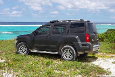
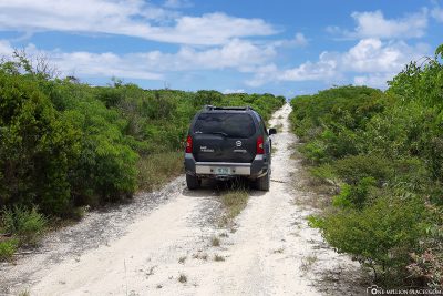
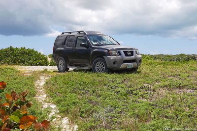
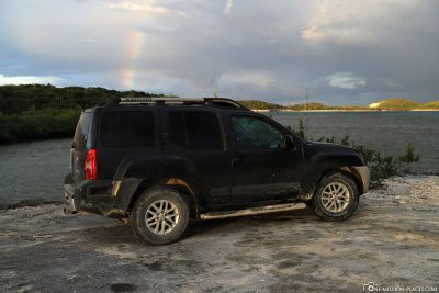
Through our Hotel Stella Maris we have booked a rental car for about 100 USD. This one was uncomplicated right in the morning in the hotel parking lot and that’s where we parked it again in the evening. It doesn’t really get any more comfortable.
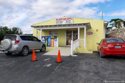
At the start of our tour across the island, we covered ourselves in a supermarket with drinks and snacks for the day. The largest supermarket on the island is Hillside Food Supply, located in the municipality of Salt Pond in the middle of the island. The “big” is of course always relative, but nevertheless the shop was well sorted. Across the island you will often find small kiosks, which only carry a very small stock of food.
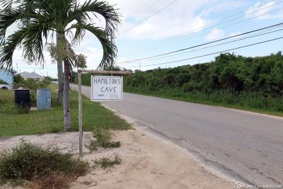
Hamilton’s Cave
Our first stop was the famous Hamilton’s Caveon the island, one of the largest caves in the Bahamas. Since the cave is privately owned, you can only visit it as part of a cave tour, for which you have to register in advance by phone and pay a fee of 15 USD per person. The telephone registration had taken over our hotel for us, so we waited for the owner: Mr. Leonard Cartwright at the agreed time at a small house on Queen’s Highway. When we met him, we drove him to the hell entrance, which was only a few hundred meters from his house.
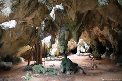
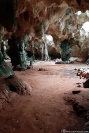
At the entrance of the cave Leonard told us a bit about the cave system and equipped us with flashlights. We walked through the cave with him for about 45 minutes, could see stalactites, stalagmites and crystal formations, but also fossils and many bats that found a home in the cave. We did the tour in the morning. However, a visit in the afternoon around 2 pm to 3 pm is particularly recommended when the sun rays shine into the cave. This certainly results in very nice photo motifs.

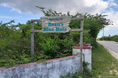
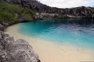
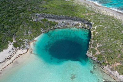
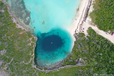
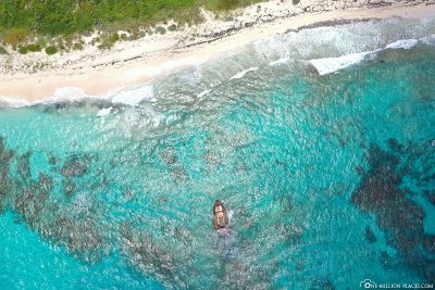
Dean’s Blue Hole
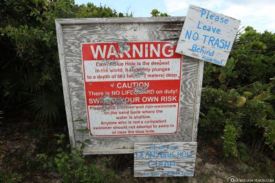
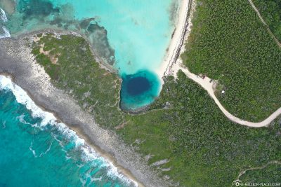
Our highlight on Long Island was the Dean’s Blue Hole, which is located in a bay west of Clarence Town. With a depth of 202 meters, it is one of the deepest blue holes in the world. We had already seen the 125 meter deep Great Blue Hole in Belize on our world tour as part of a helicopter flight and that was insanely breathtaking. But the great thing about Dean’s Blue Hole is that it is only a few meters from the shore and you can swim easily from the beach. But that’s also a bit creepy, because you move from the bright ground to a deep black hole … and that really costs a lot of overcoming. It’s best not to think about what could swim under one at such a moment 😉
Since 2008, the Vertical Blue Championship in freediving has been held here every year, which unfortunately has already claimed one fatality in 2013. The competition is very popular among elite athletes, many world records have already been set here.
At Dean’s Blue Hole we were almost alone. Which sights in the world do you already have? This is not uncommon on Long Island!

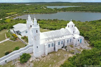
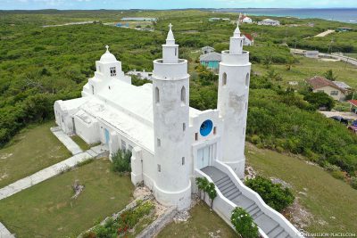
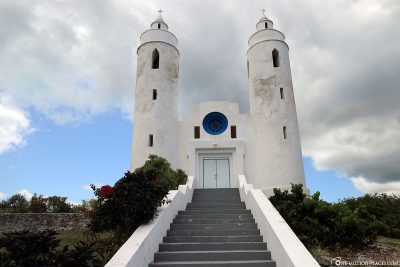
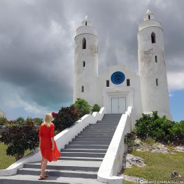
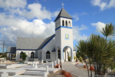
The Church of St. Peter’s and St. Paul’s
In the municipality of Clarence Town stands the Catholic Church of St. Peter’s & St. Paul’s, which with its twin towers is a small landmark of the island. It is located on a hill overlooking The Port of Clarence Town. Unfortunately, the doors were locked so we couldn’t look inside. But we let our drone go up here to photograph the church again from a different angle.
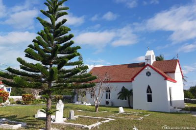
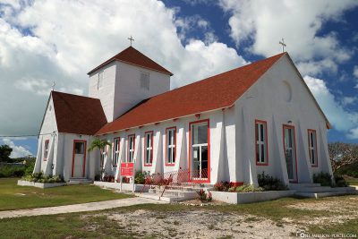
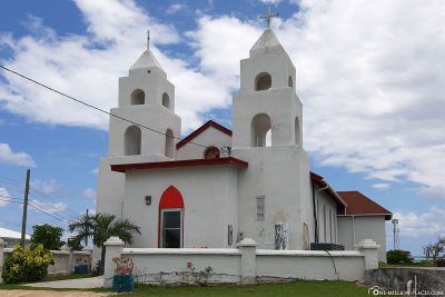
In addition, there are many other beautiful little churches that we could find on our drive along the Queen’s Highway to the right and left of the road.
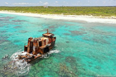
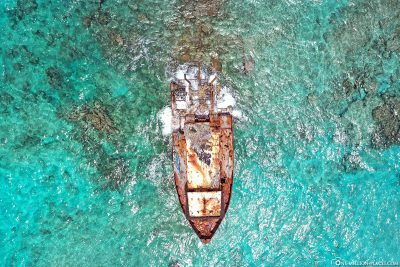
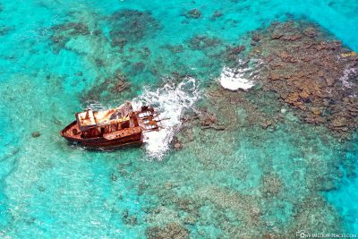
Shipwreck on the East Coast
On the east coast there is a beach in the municipality of Morrisville, from which you can admire an old shipwreck in the water, which has already come of age. If you drive the Queen’s Highway south, it is best to pay attention to the “On the Go” Takeaway Restaurant, which is located on the right side of the road. Opposite on the left side of the road there are bumpy gravel roads, all of which lead directly to the Atlantic coast. That means just turning, driving one of the bumpy roads to the end, turning off the car and going to the beach. Then the road to the shipwreck should not be that far. Again we unpacked our drone and took some pictures directly above the shipwreck.
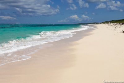

Gordon’s Beach (South End)
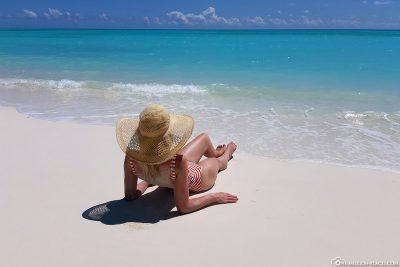
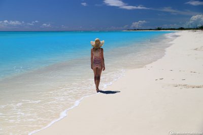
Gordon’s Beach marks the southern end of Long Island. You get here by driving the Queen’s Highway to its southernmost end and then turning right on a small road that leads directly to the beach. This beach was for us the most beautiful on the whole island. Miles of fine white sand combined with turquoise blue, crystal clear water: the perfect mix for a paradise dream beach. And best of all, there was no one else here, we were mother-soul-alone – as so often on Long Island.
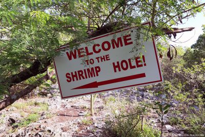
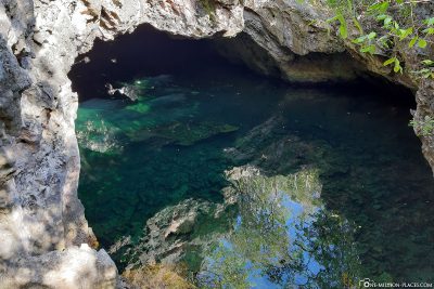
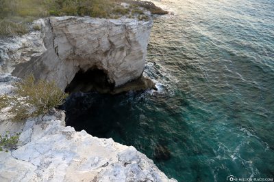
Shrimp Hole
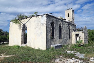
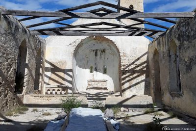
In the municipality of The Bight, which is located about in the middle of the island, directly on the Queen’s Highway stands the ruins of an old Anglican church. We just parked our car at the side of the road and took a closer look at the church. Directly behind the church, the path starts to reach the Shrimp Hole. The path is not to be overlooked, as it is very well signposted (red arrows). If you have fought your way through the mosquito-strewn forest, you will be standing in front of the Shrimp Hole within a few minutes.
The Shrimp Hole is practically a water-filled cave where you can find shrimps and small crabs. The bright red shrimp can be seen very well from the water surface. Since we were attacked by mosquitoes, we only took a few photos and then quickly ran back to the car. Basically, you can also go for a swim in the refreshingly cold water of the Shrimp Hole.
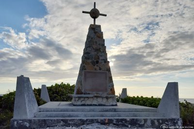
Columbus Monument
The Columbus Monument in the north of the island commemorates the explorer Christopher Columbus, who came to the island in 1492. You can drive to the bottom of the monument and then only have to climb a few meters to the monument. However, the road was until then a pure gravel road. We have seen that a relatively large amount of forest has been cleared here to build a new road to the monument. But it will certainly take a while before it is ready.
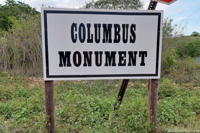
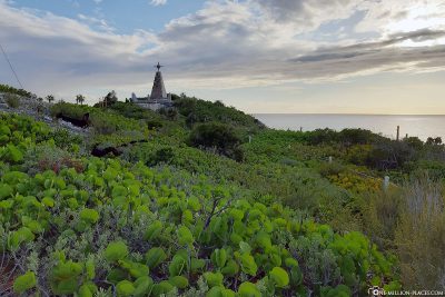
From the monument you have a fantastic view of the coast, but also of the turquoise lagoon, which we had already explored by kayak. Simply fantastically beautiful! 🙂
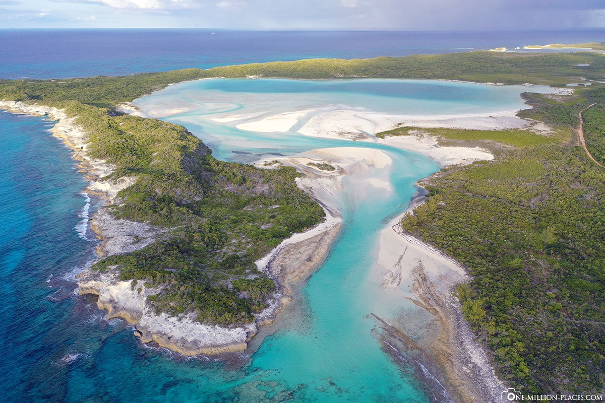
The dreamlike bay in which we laid out by kayak
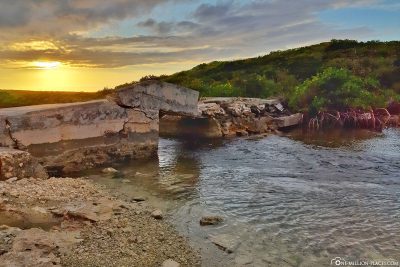
Sunset at the North End
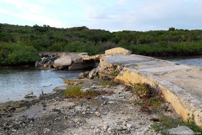
As the last stop of our island tour we wanted to drive the Queen’s Highway to its northern end. The end is marked by the Broken Bridge Bar & Grill, which is located directly on Columbus Harbour.
Today we drove a total of 162 kilometers over the island, started at 8 o’clock in the morning and were back at the hotel around 8 p.m. A long busy day. On our way back, we quickly refueled for 20 USD at one of the few gas stations. A gallon of gasoline (3.8 liters) currently costs about 5 USD.
All travelogues from the Bahamas
The Bahamas have been on our bucket list for a really long time. And this year we had found a relatively good and cheap flight offer to combine the Bahamas with a few days in Florida afterwards. On our trip we visited different islands on the Bahamas in 9 days and these are our travel reports:
» Travel Planing: The Bahamas and Florida & our flight to Nassau
» New Providence: Tourist Attractions, Things to Do & Photo spots in Nassau
» New Providence: Hotel Atlantis & Paradise Island
» Exumas: Flight to Great Exuma Island & Hotel in George Town
» Exumas: Beaches & Sting Rays feeding on Stocking Island
» Exumas: The swimming Pigs of Big Major Cay
» Exumas: Swimming with the nurse sharks of Compass Cay
» Long Island: The Stella Maris Resort & our Kayak Tour
» Long Island: Self guided tour around the island by car
» Long Island: The swimming Pigs at Dove Cay
» Long Island: Diving in the underwater world of the Caribbean