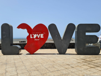
The west of La Palma is one of the main tourist areas of the island. It is often sunny and warm here, because the slopes of the Cumbre Vieja mountain range, which is up to 2,000 meters high and 14 kilometers long, mostly keep out the trade wind clouds, wind and rain. On the west side of La Palma you will find, among other things, the “secret capital” Los Llanos de Aridane, the coastal town of Tazacorte, the smuggler’s bay Poris de Candelaria and many beautiful beaches such as Playa de Puerto Naos or Playa Nueva.
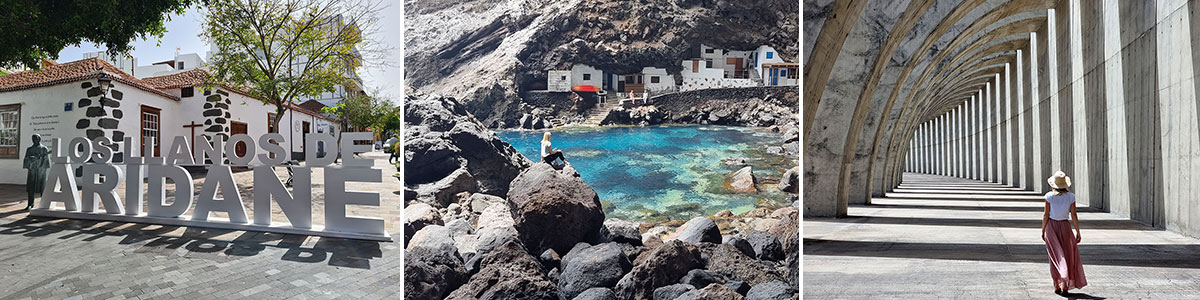
Table of contents
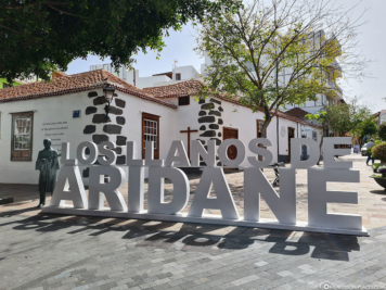
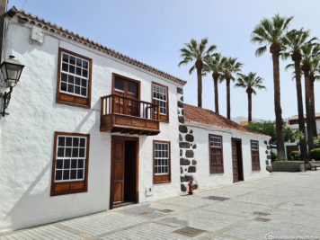
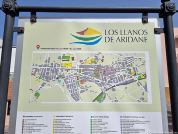
The small town of Los Llanos de Aridane
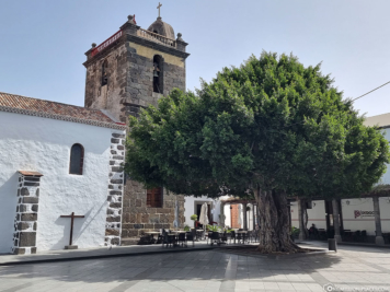
The town of Los Llanos de Aridane was founded in the early 16th century with the construction of the church Nuestra Señora de Los Remedios, making it one of the oldest towns on La Palma. The addition “de Aridane” carries Los Llanos to distinguish it from other places of the same name. Meanwhile, the city has about 20,000 inhabitants and has thus developed over time to the most populous city on the island and already surpassed Santa Cruz de La Palma in the 1990s. Therefore, it often bears the nickname “secret capital”.
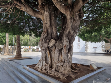
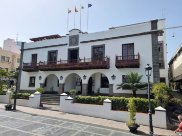
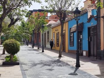
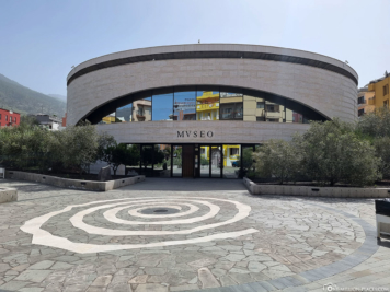
We parked our rental car directly in the city center in the Centro Comercial Trocadero. From here you can easily explore the city center on foot. We walked around the old town for about 1.5 hours, exploring the main sights such as the Plaza de España with the three-nave parish church of Nuestra Señora de Los Remedios, the regional-style City Hall (Ayuntamiento), the Museo Arqueológico Benahoarita and the pedestrian street of Calle Réal.
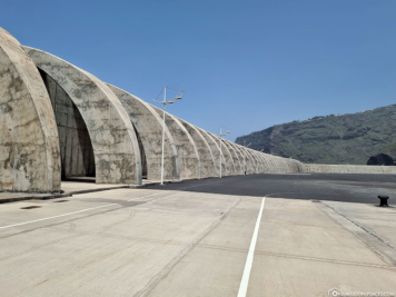
The breakwaters in the port of Tazacorte
If you’re looking for famous Instagram & photo spots on the island of La Palma, you’ll inevitably end up at the massive breakwaters in the small coastal town of Tazacorte, which is also the sunniest place on the island with 3,500 hours of sunshine a year.
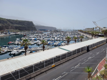
The modern port of Puerto de Tazacorte was built from 1976 to 1981 and is now the largest port on the island. From 1999 to 2003, the port was expanded, as it was hoped that larger cruise ships would also dock here on the west coast of La Palma. Unfortunately, this has not been confirmed. To date, all major cruise ships and ferries continue to dock in the port of the capital Santa Cruz de La Palma.
Since the waves of the Atlantic Ocean can reach several meters high, especially in winter on the west coast, two huge breakwaters (piers) made of concrete were built to protect the marina and the beach. The first breakwater is 176 meters long, the larger one even 400 meters.
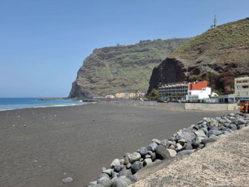
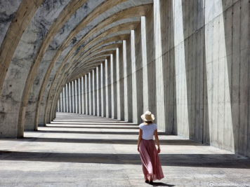
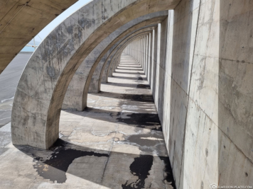
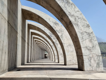
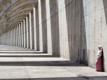
Visually, these huge concrete harbor walls are now not really nice for the landscape – but offer in combination with the sun and the shadows of the archways a really great photo motif, right? 🙂
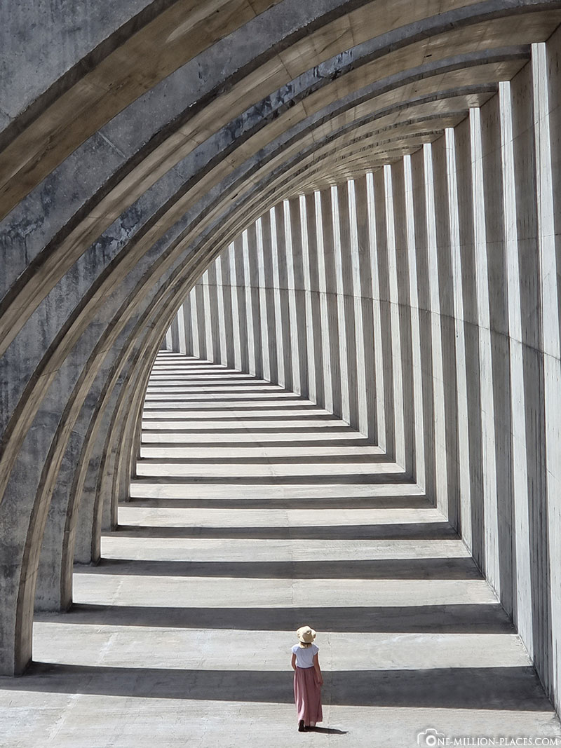
The breakwaters in the port of Tazacorte
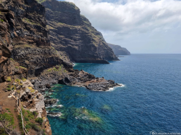
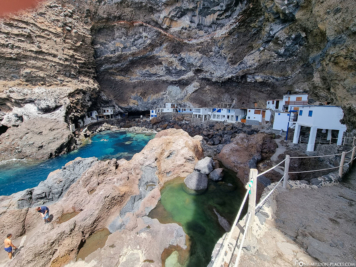
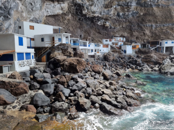
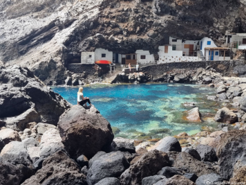
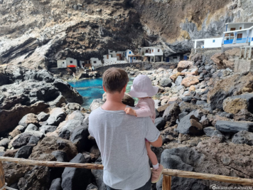
The smuggler bay Poris de Candelaria
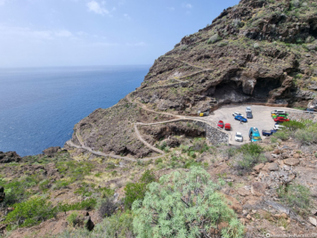
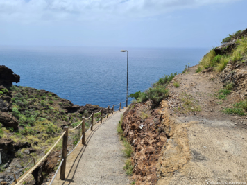
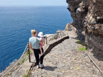
A special highlight and another great photo motif on the west coast of La Palma is the smuggler’s bay Poris de Candelaria. The Pirate Bay is located near the Cueva Bonita near Tijarafe and was used in the past – when there were no roads on La Palma – by the locals as a small port for goods of all kinds. The well-protected bay is hidden under a huge rock overhang about 50 meters high on the steep coast of the island.
To get to Pirate Bay, you can either take a steep hike of several hours from Tijarafe or drive by car on an adventurous narrow road over many switchbacks and banana plantations almost to the bay. There are 2 smaller parking lots here (location in Google Maps), which will probably fill up quickly, especially on weekends. However, we immediately got a parking spot during the week and walked the short distance from there down to the bay.
In the bay, besides the turquoise waters, you will find mainly about 20 small white stone houses, either cut directly into the rock or somehow built in between. Unfortunately, there are no sanitary facilities. Pirate Bay is today mainly a tourist destination and the cottages are inhabited mainly on weekends by local fishermen, who then also sell their wares here.
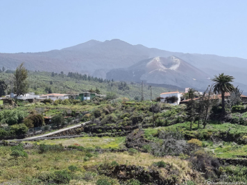
The volcanic eruption of Cumbre Vieja in 2021
The last volcanic eruption on the island of La Palma was the eruption of Teneguía in 1971 at the southern tip of the Canary Island. Since then, apart from a few earthquakes, the island has been relatively quiet. But in 2021, the Cumbre Vieja volcanic eruption began on September 19 and continued until December 13, 2021. Thus, it counts today as the longest known eruption of a volcano on La Palma. In terms of damage, it was the most momentous in the island’s history.
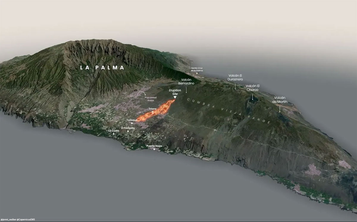
The volcanic eruption of Cumbre Vieja
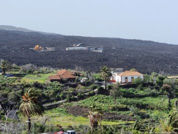
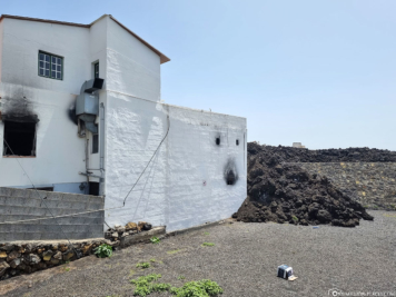
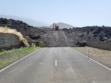
The lava emerging from several fissures flowed westward across the densely populated plain and down the cliff into the sea. A good overview of the lava flow can be seen in this drawing. The eruption destroyed many houses and roads in the municipalities of El Paso, Los Llanos de Aridane and Tazacorte, and covered a large agricultural area. In total, the lava masses destroyed more than 1,600 buildings, 1,300 of which were residential. The lava also buried more than 70 kilometers of roads and 370 hectares of banana plantations.
During our visit in April 2022, 4 months after the official end of the eruption, the devastating destruction was still visible everywhere. Many roads were still closed (e.g. the LP-301 or the LP-2) and you can see destroyed houses and plantations everywhere.