After our stay in Bryce Canyon National Park, we continued our journey to the north-east. About 180 kilometers and a 2-hour drive away is Capitol Reef National Park, a national park that we had actually never heard of before. We were all the more excited to see what we would discover here.
Table of contents
Interesting facts about Capitol Reef National Park
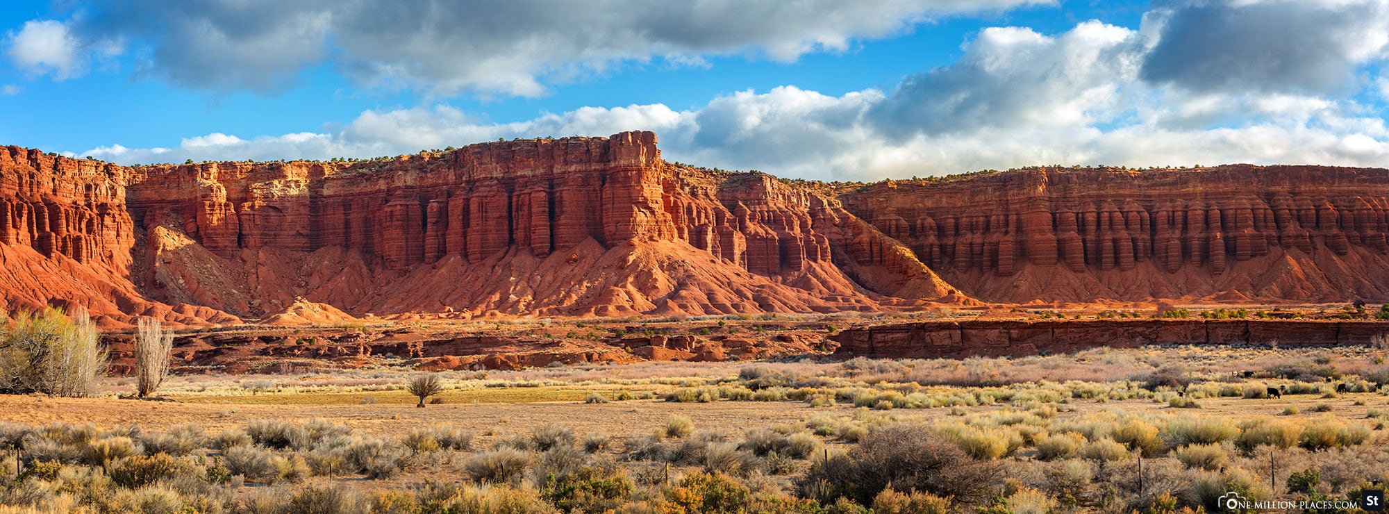
Capitol Reef National Park in Utah is a unique place with impressive geological diversity and a rich history. The park covers an area of around 979 square kilometers and lies at the heart of the so-called Waterpocket Fold, an almost 160-kilometer-long geological fold that was formed over 65 million years ago. This folded structure, which dominates the park, shows a spectacular sequence of cliffs, canyons, domes and natural bridges that have been exposed by erosion over the course of time. Particularly noteworthy is the name of the park, which is derived from the characteristic white sandstone domes, reminiscent of the Capitol building in Washington, D.C., and the steep rock faces that once acted as insurmountable barriers for pioneers and explorers.
In addition to the geological aspects, Capitol Reef National Park is also known for its historical significance. There are numerous petroglyphs in the park area that originate from the indigenous people of the Fremont culture, who lived in this region around 1,000 years ago. These rock carvings provide insights into the life and spiritual world of these ancient cultures. In the 19th century, the area was settled by Mormon pioneers who established small farming communities along the Fremont River. One of these settlements, Fruita, is now a historic site in the park, offering a fascinating insight into the lives of the early settlers with its orchards, old buildings and irrigation systems.
Visitors can hike, camp, climb and explore the spectacular landscape on numerous trails in Capitol Reef National Park. Particularly popular are the Hickman Bridge Trail, which leads to an impressive natural stone bridge, and the Cassidy Arch Trail, named after the notorious outlaw Butch Cassidy. Due to its remote location, the park is often less crowded than other national parks in Utah, making it an ideal place for those who want to enjoy the beauty of nature in peace.
Opening hours, weather & admission
Capitol Reef National Park is open around the clock all year round. The Visitor Center is open daily (except on some public holidays) from 8.00 am to 4.30 pm, with extended opening hours in summer. Compared to many other desert areas in Utah, the park lies at an altitude of 1,500 meters. Winters can therefore be cold and snowy, while summers can be very hot, but not unbearably so. For us (mid-May) it was pleasantly warm during the day, but you needed a sweater or jacket in the evening.
In contrast to many other national parks such as Bryce Canyon, Yosemite National Park or the Grand Canyon, Capitol Reef National Park does not have a toll station. You can cross the park on Utah State Route 24, for example, and don’t have to pay anything. However, if you want to see something or drive the park’s 12.7-kilometer Scenic Drive, the following entrance fees apply:
– Private vehicle: 20 USD, valid for 7 days
– Individuals (pedestrians and cyclists): 10 USD per person, valid for 7 days
– Motorcycles: 15 USD, valid for 7 days
– Capitol Reef Annual Pass: 35 USD per year
The passes are of course available at the Visitor Center. There is also a self-pay box at the start of Scenic Drive (location in Google Maps). Good to know: There are also certain days of the year when entry to Capitol Reef National Park is free. These days are often associated with national holidays or special occasions. An overview of the free days can be found on the official website of the national park.
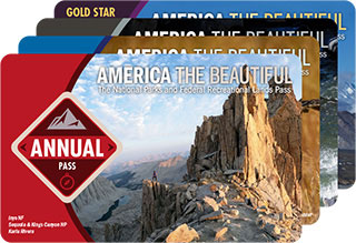
If – like us – you want to visit several national parks on your route through the USA, then we recommend the America the Beautiful Pass. This annual pass costs 80 USD and grants access to all national parks and other federally managed recreation areas in the United States for one year. You can easily buy the America the Beautiful Pass in almost every national park. Just ask at the ticket booth 🙂
You can find more information about the America the Beautiful Pass here.
A map of Capitol Reef National Park
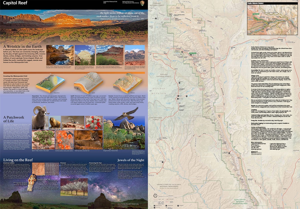
The following map clearly shows the gigantic size of Capitol Reef National Park. The park boundaries extend along the Waterpocket Fold, a 160 km long geological formation that stretches in a north-south direction. The park is around 100 km long, but relatively narrow with a width of around 10 km.
A complete map of the national park can be downloaded here as a .pdf version free of charge.
Visitor Center & Fruita Historic District
The Capitol Reef Visitor Center is located just off Highway 24 outside the historic settlement of Fruita, about 7 miles from the park’s west entrance and 8.4 miles from the east entrance. The visitor center is open all year round and offers information and various exhibitions. A museum offering insights into the geology, archaeology and history of the region is also available for exploration. The Visitor Center is open daily, from March to October from 8 am to 4.30 pm and November to February from 9 am to 4 pm.
If you continue along the Scenic Drive from the Visitor Center, you will reach the “ghost town” of Fruita. The area was originally founded by Mormon settlers in the late 19th century and served as an agricultural community for a long time. Today, the Fruita Historic District is known for its well-preserved gardens and historic buildings. Visitors can explore the picturesque orchards, where fruit trees such as apples, peaches and pears are still cultivated, completely free of charge. The Gifford Homestead, a historic farmhouse that has been converted into a small museum and store, is particularly charming. Here, visitors can buy homemade products such as jams, bread and cakes prepared according to traditional recipes.
We got ourselves a delicious ice cream here and had a little picnic on the lawn in front of the house 🙂
Capitol Reef Scenic Drive
Shortly after the Fruita Historic District, the Capitol Reef Scenic Drive begins, an approximately 13-kilometer-long panoramic road through the national park. It winds its way through an impressive landscape of deep red rock formations, steep cliffs and narrow canyons. There are several stops along the route where you can enjoy spectacular viewpoints or go on hikes.
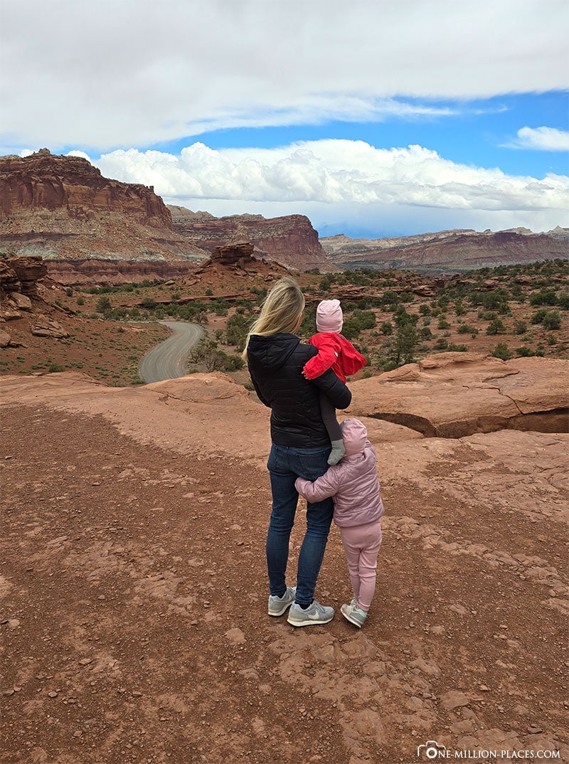
The most famous viewpoints are the Grand Wash and Capitol Gorge, two side gorges that offer deep insights into the geological layers of the region. The Scenic Drive is mostly paved, although some sections such as the turn-offs to the Grand Wash and Capitol Gorge are gravel roads. Unfortunately, we could only drive a small part of the Scenic Drive, as it was closed at our time from the turn-off to Grand Wash Road due to restoration work 🙁
Another well-known sight is the Cassidy Arch, a striking rock bridge. The hiking trail to Cassidy Arch is challenging, about 5.5 kilometers long and leads over steep climbs and rocky paths that run along cliffs. We didn’t do this hike with our two kids. But down by the road you can also see Cassidy Arch quite clearly in the distance.
You can find a good overview of the various sights along the Scenic Road here.
Petroglyph Panels
The Petroglyph Panels in Capitol Reef National Park are a collection of petroglyphs carved into the rock faces by the indigenous people of the Fremont culture around 700 to 1300 years ago. These ancient works of art are located along Utah State Route 24, especially visible near the visitor center (location in Google Maps).
The petroglyphs show a variety of motifs, including human-like figures, animals such as snakes, mountain sheep and birds, as well as abstract symbols whose exact meaning remains a mystery to this day. These rock carvings provide valuable insights into the life and spirituality of the Fremont people and are impressive evidence of the long history of human settlement in the region.
Rock formation The Castle
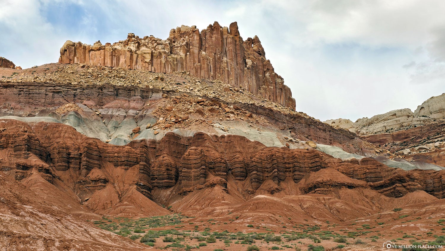
For us, one of the most beautiful photo motifs in Capitol Reef Nation Park is The Castle rock formation. This impressive geological structure consists of layers of Wingate sandstone that have been sculpted by erosion over millions of years into the shape we see today. With its steep, jagged walls and battlements, The Castle is reminiscent of the remains of an ancient castle, perched high above the desert landscape. It is located near the visitor center and is one of the park’s best-known and most photographed landmarks.
Temple of the Sun & Temple of the Moon
Unfortunately, we didn’t manage to explore all the famous sights of the national park in our two days. The park is simply too big for that and some sights can ideally only be reached with a 4×4 four-wheel drive car.
What we unfortunately didn’t see ourselves, but don’t want to withhold from you, is the Temple of the Sun and the Temple of the Moon. These are two impressive rock formations in the remote Cathedral Valley of Capitol Reef National Park. These monoliths, made of Navajo sandstone, rise up from the desert plain and look like gigantic, naturally created temples that are worshipped by the sun and the moon. The Temple of the Sun is slightly taller and more massive, while the Temple of the Moon is slimmer and more elegant, but both formations are remarkable for their symmetrical shape and sheer size, making them appear like sacred monuments amidst the rugged landscape.
The temples are particularly impressive at sunrise or sunset, when the light bathes the rocks in warm shades of gold and red and makes them literally glow. The area around the two temples is remote and requires a drive on unpaved roads. If, like us, you don’t have a 4×4 rental car, we recommend a guided tour. You can book these via GetYourGuide, for example.
Hickman Bridge
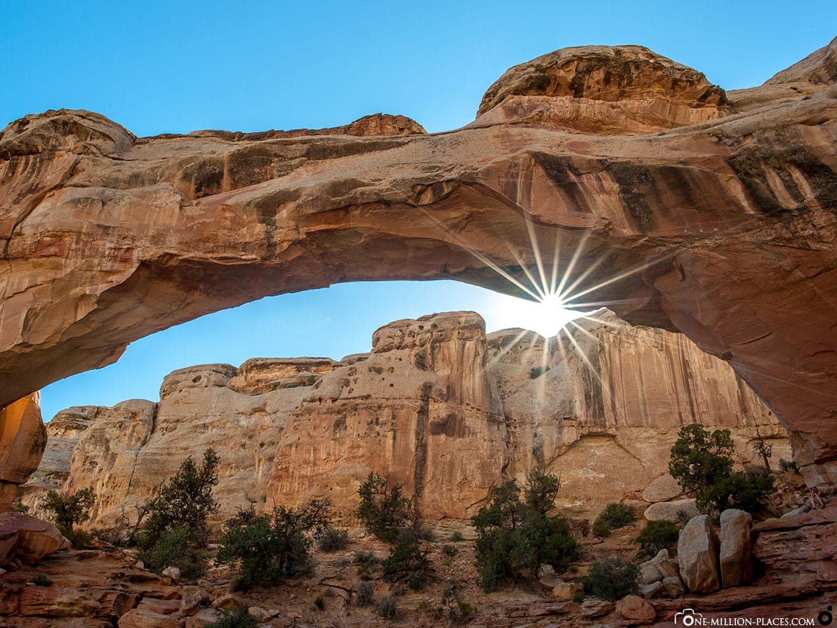
Another well-known sight that we unfortunately didn’t manage to visit is the Hickman Bridge. Hickman Bridge is one of the most famous natural rock bridges in Capitol Reef National Park. This impressive formation of Navajo sandstone stretches elegantly over a small gorge some 40 meters in length and is a spectacular example of the geological forces that have shaped the park.
The hiking trail to Hickman Bridge is about 2.4 kilometers long (outward and return) and leads through a varied landscape characterized by desert vegetation, colourful rocks and occasional views of the Fremont River. The hike is moderately difficult and requires some slight ascents, but it is well marked and offers many interesting stops, including ancient rock carvings from the Fremont culture and smaller natural rock arches.
Junior Ranger program for children
Desert landscapes, canyons, rocks and natural stone arches may not necessarily be the highlight for small children. However, to make exploring national parks a little more exciting for kids, there is a so-called Junior Ranger program in almost every large national park.The program is an exciting and educational way for children and young people to discover the nature and history of the national parks. A Junior Ranger booklet is available at the Visitor Center, which contains a series of tasks and activities specifically designed to promote an understanding of the nature, geology and culture of the park. These tasks range from puzzles and observations to small research assignments and art projects. The young explorers learn a lot about the animal and plant world, the history of the indigenous people, the special features of the rock formations and the protection of natural resources. Once they have completed the booklet, they can hand it in to a ranger at the visitor center. After a short “ranger ceremony”, the children then receive an official Junior Ranger badge, which then distinguishes them as ambassadors of the park.
At 3.5 years old, our daughter was still a bit too small for the tasks. But of course we got the Junior Ranger booklet anyway and if you ask nicely, you can of course also get the Junior Ranger badge. She was always very proud of it. And if you do this in several national parks, you end up with a nice collection 🙂
Our Hotel Capitol Reef Resort
We chose a hotel near the national park, about 1.5 miles from the park entrance. The Capitol Reef Resort is a charming accommodation that offers a breathtaking view of the surrounding red rocks and the vast desert landscape. The resort offers a variety of accommodation options, ranging from classic hotel rooms and rustic wooden cabins to luxurious glamping tents and traditional tipis. Particularly noteworthy are the authentic western wagons, which are designed in the style of the pioneers and offer unique overnight accommodation.
We had a “Traditional 2 Queens” room and paid 336 EUR for 2 nights. Certainly not cheap accommodation, but the location is really perfect for exploring Capitol Reef National Park. The nearest small town, Torrey, is also only about 5 minutes away by car.
Is a visit to Capitol Reef National Park worthwhile?
Capitol Reef National Park is certainly one of the less visited national parks in the Midwest of the USA. Which is also nice, because the park is never overcrowded due to its size. For comparison: around 5 million people visit the Grand Canyon or Zion National Park every year, 2.5 million the Bryce Canyon and around 1.8 million the Arches National Park. Capitol Reef National Park, on the other hand, “only” has around 1.2 million visitors a year.
We found the huge mountain cliffs, the colors and the vastness of the park very impressive. It was a shame that the Scenic Drive was partially closed at the time we were there, so we were only able to explore a very small part of the park. We would also have needed 1-2 more days to explore other parts of the national park.
All in all, a visit to Capitol Reef National Park is definitely worthwhile! 🙂


