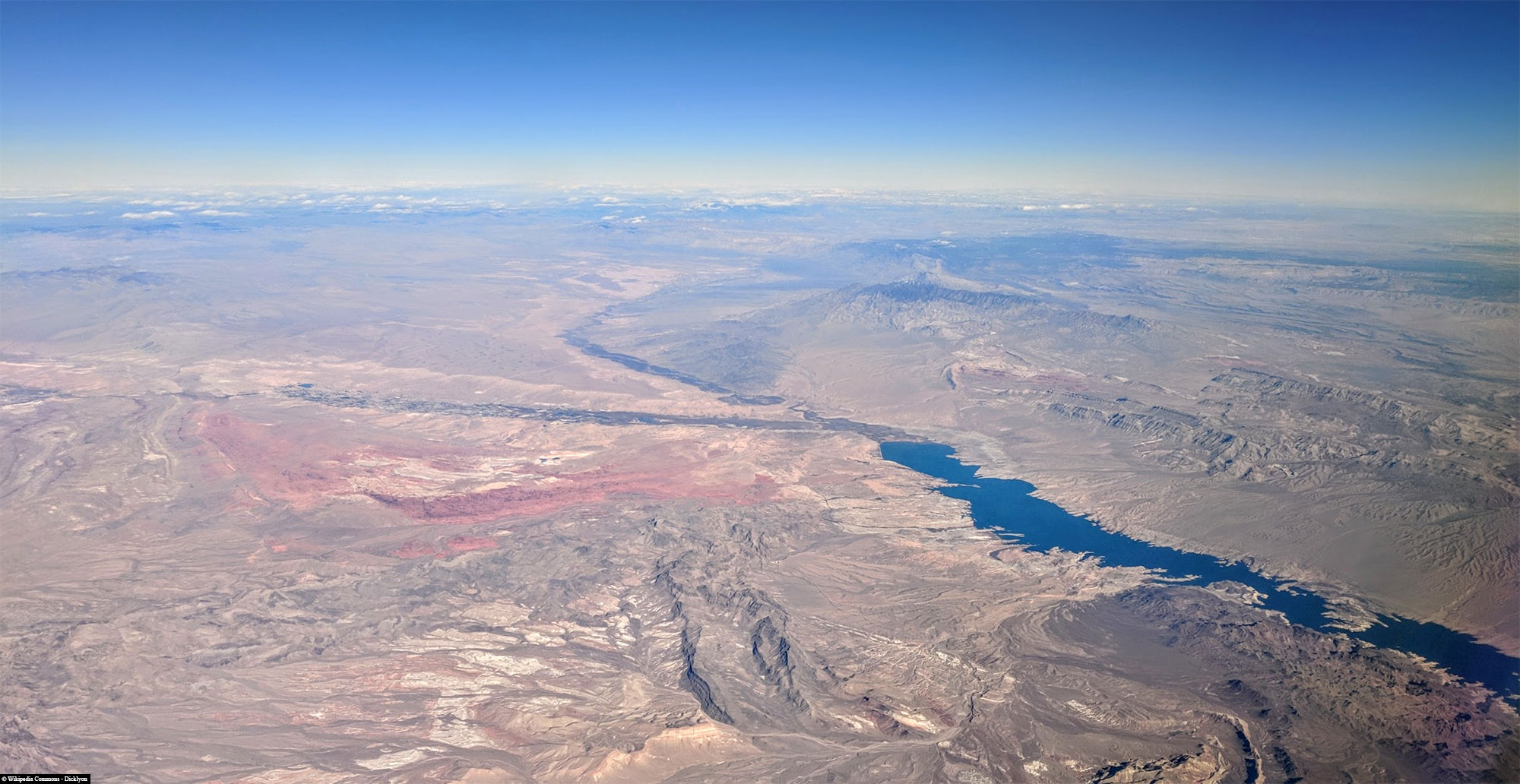
We started our big round trip through the Midwest of the USA from Las Vegas. Our first stop was the Valley of Fire State Park, which is only around 80 kilometers northeast of Las Vegas. As the park was completely new to us, we were very excited to see what would await us here.
Table of contents
Things to know about the Valley of Fire State Park
The Valley of Fire State Park is the oldest and largest state park in Nevada and was opened in 1935. The 141 km² state park is located in the Mojave Desert around 80 kilometers north-east of Las Vegas at an altitude of 610 to 790 m.
The Valley of Fire derives its name from the red sandstone formations (the Aztec Sandstone), which were formed 150 million years ago from large shifting dunes and which glow like “fire”, especially at sunrise and sunset. Complex uplift and subsidence of the entire region, followed by extensive erosion, have created the present landscape. Other significant rock formations consist of limestone, shale and conglomerate rock.
The prehistoric inhabitants of the valley included the Ancestral Puebloan, also known as the Anasazi, who were farmers from the nearby fertile Moapa Valley. Their approximate occupation span was dated from 300 BC to 1150 AD. Some examples of the impressive rock art (petroglyphs) left behind by these ancient peoples can be admired in several places in the park.
The Valley of Fire State Park has a visitor center and facilities for picnicking, camping and hiking and attracts around 1 million visitors a year. It is particularly popular with tourists for day trips from Las Vegas. The park is open 365 days a year, from 8.30 am to 4.30 pm.
The entrance fee is 10 USD per vehicle.
Map of the Valley of Fire State Park
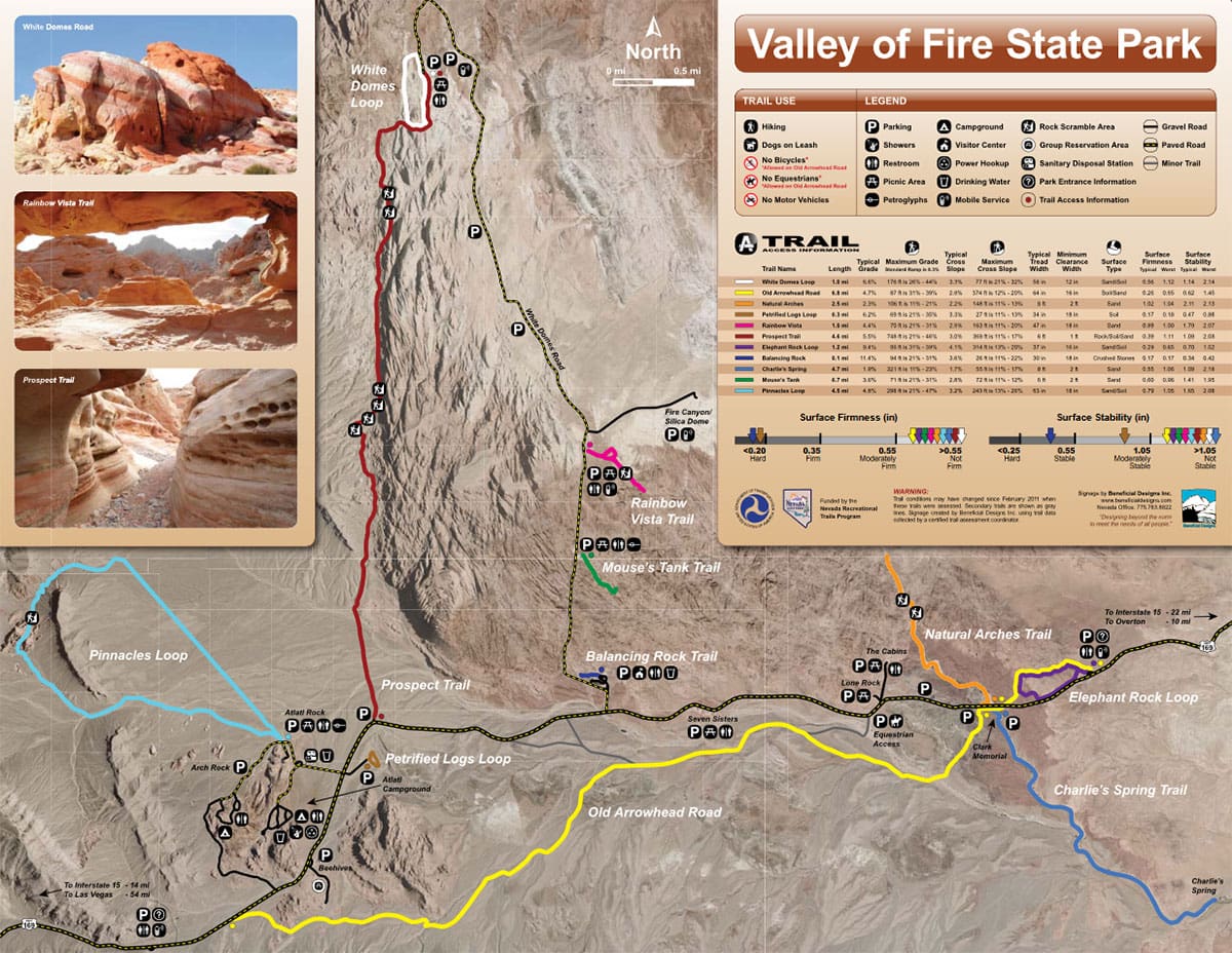
The following map shows the roads, sights, hiking trails and the Visitor Center. The map can be downloaded here free of charge as a .pdf version.
Visitor Center
The Visitor Center in the Valley of Fire State Park is the central point of contact for visitors who want to learn more about the fascinating geology, history and wildlife of the park. It is located at the start of Mouse’s Tank Road and offers an informative exhibition that clearly explains the geological processes that led to the formation of the striking sandstone formations. There are also exhibits on the prehistoric cultures that once inhabited this region, including artifacts and information about the petroglyphs in the park. The visitor center also has a small souvenir store.
The visitor center is open daily from 9 am to 4 pm.
Sights & photo spots in the Valley of Fire State Park
Atlatl Rock & Arch Rock
If you drive into the Valley of Fire State Park from Las Vegas, the first attraction on your left is a small loop to Atlatl Rock and Arch Rock.
Atlatl Rock is particularly famous for its impressive rock formations and its well-preserved petroglyphs, which originate from the indigenous people of the region. The name “Atlatl Rock” is derived from an ancient hunting weapon, the atlatl, which is also depicted on the petroglyphs. In addition to the atlatls, the images on the rock face also show other symbols and figures that reflect the cultural and spiritual world of the early inhabitants.
To see the petroglyphs up close, a steep staircase leads up the rock. The view from up there not only offers a close-up view of the ancient rock carvings, but also an impressive view of the surrounding landscape of the Valley of Fire.
If you drive a little further along the loop, you come to Arch Rock. Arch Rock is a rock bridge made of sandstone that has been shaped by erosion over thousands of years. Although the formation itself is relatively small compared to other natural arches, it is still a popular destination. The rock bridge can be seen directly from the road and is located near Arch Rock Campground, a popular campground in the park.
Balancing Rock
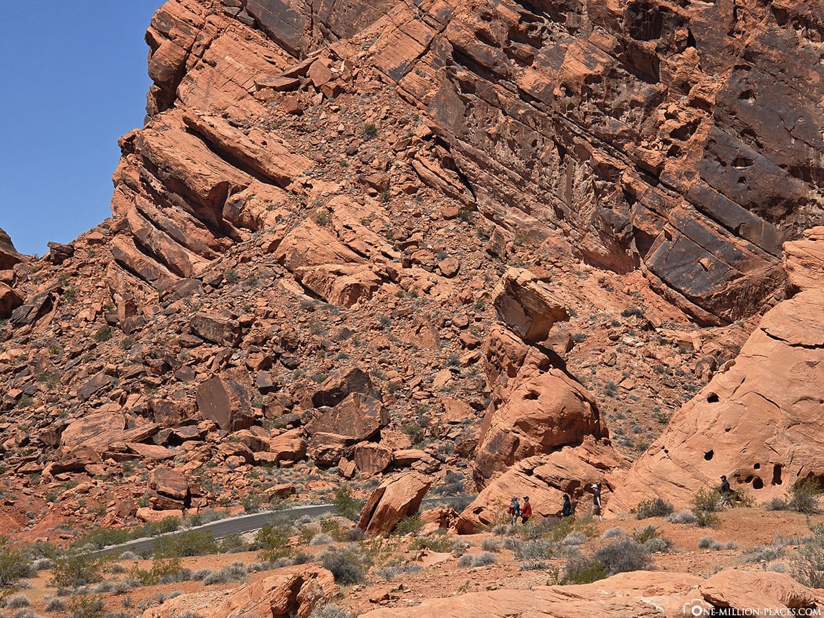
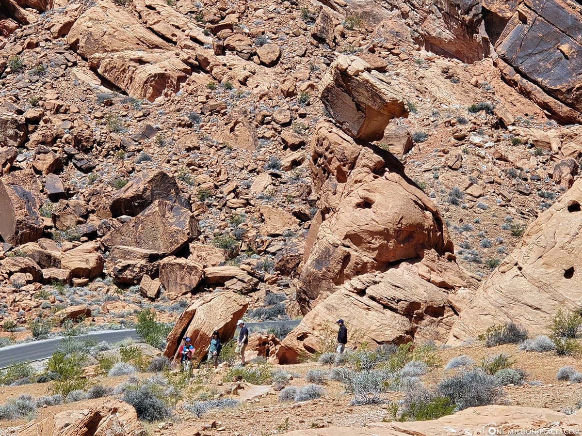
Balancing Rock is one of the special natural rock formations in the Valley of Fire. As the name suggests, this rock seems to balance in an almost impossible way, as if it could topple over at any moment. This geological formation is a prime example of the erosive forces that have shaped the landscape of the Valley of Fire over millions of years.
Balancing Rock is not far from the park’s visitor center, making it an easily accessible attraction for visitors. The rock itself is made of red Aztec sandstone, which is typical of the Valley of Fire and gives the park its characteristic name. The red color of the rocks glows particularly intensely in the morning and evening light.
Beehive Rocks
The Beehives in the Valley of Fire State Park got their name from their striking resemblance to traditional beehives. The Beehives were formed by the action of wind and water, which eroded the sandstone in concentric, horizontal layers. This layering gives the rocks their characteristic striped appearance, reminiscent of the slats of a beehive. The round, dome-shaped structures are a prime example of the natural sculptural art found in the arid desert environment of the Valley of Fire.
Fire Wave
The hike to Fire Wave is probably the best known and most popular hike in the Valley of Fire State Park. To escape the midday sun, we also did this hike in the morning. The starting point for the hike to Fire Wave is at the end of Mouse’s Tank Road. There is a marked parking lot with signs indicating the start of the trail. The trail is classified as easy to moderately difficult and is 2.4 kilometers round trip. There are no major differences in altitude, but the path leads over sandy and rocky sections.
It took us about 20 minutes from the parking lot with 2 children in the stretcher and several photo stops to get to the Fire Wave.
“The hike to Fire Wave is generally closed from June 1 through September 30 each year to protect hikers from the dangerous conditions of the extreme summer heat. Temperatures in the desert can rise well above 40°C during this time!” (Nevada State Parks)
The Fire Wave is a geological feature and resembles a wave that has been frozen in the sand. These undulating lines and bands are the result of wind and water erosion, which have sculpted the sandstone over long periods of time.
We really liked it here and the Fire Wave is a really great photo motif 🙂
7 Wonders Loop
Directly adjacent to the Fire Wave is another 2.4-kilometer hike, the 7 Wonders Loop.
The 7 Wonders Loop leads through a fascinating desert landscape known for its bright red rocks, unique geological structures and picturesque views. Here, for example, you can hike through the “Pastel Canyon” or “Pink Canyon”, which impresses with its narrow, colorful sandstone walls in pastel colors.
This section of the hike from the Fire Wave via the 7 Wonders Loop back to the parking lot took us around 45 minutes.
White Dome Loop
The White Domes Loop is about 1.1 miles (approx. 1.8 km) long and begins in a wide, open landscape characterized by the eponymous white sandstone formations. These rocks stand out from their surroundings due to their bright color and imposing size. One section of the hike leads through a narrow slot canyon, which is known for its narrow walls and dramatic light conditions. This is one of the most scenic parts of the trail. Along the way, you will come across the remains of an old film set. These ruins are from the 1966 western film “The Professionals”.
Due to time constraints, we didn’t actually do the White Dooms Loop, but only took a short break in the large parking lot. The parking lot is also the end of the road through the Valley of Fire, from here you have to drive all the way back again.
Fire Canyon
Next, we turned into the “Fire Canyon Road” junction. From here it is only about 1 kilometer by car to the viewpoint of the Fire Canyon. Fire Canyon is, as the name suggests, a canyon of fiery red rock formations. It looked very interesting and unusual how the mountain is divided into two color halves!
In general, it’s worth looking to the left and right of the road from time to time. We have seen so-called bighorn sheep several times 🙂
Mouse’s Tank Road
Two major roads lead through the Valley of Fire State Park.
Valley of Fire Road is the main road that runs through the park between the east and west entrances. The 10.5-mile (16.9 km) stretch of road was officially designated as the Nevada Scenic Byway on June 30, 1995.
Mouse’s Tank Road is about 9 kilometers long and runs from south to north through the state park. The road starts at the Visitor Center and ends at the White Dome Loop described above. It is therefore a dead end and you have to drive back the way you came. Mouse’s Tank Road is home to the park’s most famous sights, such as the Fire Wave, the Rainbow Vista and the White Domes. Incidentally, the street is named after “Mouse’s Tank”, a natural pool of water in the park that was used as a hideout by a Southern Paiute called “Little Mouse” in the 1890s.
We found the road really beautiful to drive. Again and again there were great panoramas as well as several bays and viewpoints.
Mouse’s Tank Trail
The Mouse’s Tank Trail is an approximately 1.2-kilometer (0.75-mile) hiking trail in the Valley of Fire State Park. It leads through the colorful and sandy Petroglyph Canyon to a natural water basin known as Mouse’s Tank. The trail is relatively easy and during the hike you have the opportunity to see numerous ancient petroglyphs carved into the rocks by the indigenous people of the region. These rock paintings, some of which are over 2,000 years old, provide a fascinating insight into the culture and history of the indigenous peoples.
At the end of the trail you reach the eponymous Mouse’s Tank, a small pool of water hidden in a rocky niche.
Seven Sisters & Elephant Rock
Our last two stops in the Valley of Fire State Park were the Seven Sisters and Elephant Rock.
The Seven Sisters are a series of rock formations consisting of seven striking, towering sandstone blocks – completely isolated in the open desert landscape. This makes it a special photo spot.
Elephant Rock is one of the most famous rock formations in the Valley of Fire. As the name suggests, the shape of this natural sandstone arch is reminiscent of an elephant, complete with a long trunk and a powerful body. Elephant Rock is located near the eastern entrance to the park and is easily accessible. The rock is just a few steps from the roadside, but there is also a short hiking trail (about 0.4 kilometers or 0.25 miles) called the Elephant Rock Loop Trail that leads to a viewpoint from which visitors can see the “elephant” from different perspectives.
Is a visit to the Valley of Fire State Park worthwhile?
From our point of view, definitely YES! Compared to the large national parks such as Zion National Park, Yellowstone National Park or Yosemite National Park, the Valley of Fire is of course quite a small park. But there is still a lot to see and, above all, the short distance to Las Vegas makes the Valley of Fire an ideal day trip destination.
We spent a total of around 5 hours in the park and saw the most important things. But it’s also worth allowing a little more time to perhaps go on a hike or two. However, we still had almost 400 kilometers to go to Bryce Canyon and we didn’t want to drive on quite so late.
Overall, the Valley of Fire is a great destination and highly recommended 🙂


