
On our journey for 2 weeks across California we went after the start in San Francisco and a stop in Sacramento over the Lincoln Highway to the beautiful Lake Tahoe.
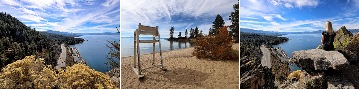
Table of contents
The Lincoln Highway
From Sacramento to South Lake Tahoe, it’s about 160 kilometers, which takes about 2 hours to drive. After visiting Sacramento in the morning, we stopped at noon at the Folsom Premium Outlets, which are only about 20 minutes from Sacramento. And so we spent a few hours here again before we made our way to Lake Tahoe around 4 p.m. Actually a pity, because it was already slowly getting dark and we didn’t get so much of the actual route. It is historically very interesting because it is part of the Lincoln Highway.
Check out our great shopping guide for the USA with lots of savings tips
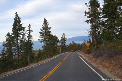
Probably the most famous street in the United States today is route 66, which connects Chicago with Los Angeles. However, Route 66 was not the first east-west axis of the United States. The Lincoln Highway was opened in 1913 and connected New York’s Times Square with Lincoln Park in San Francisco. The 5,454-kilometre road, in its original form, passed through 13 states. After some straightening, the route is still 5,057 kilometers long. If you want to drive down the Lincoln Highway today, you first have to research the route carefully, because the road officially no longer exists. But the part between Sacramento and Lake Tahoe is definitely one of them.
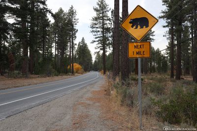
Just before reaching Lake Tahoe, the Lincoln Highway still leads over the 2,250-metre-high Echo Summit mountain pass,from which you have a great view of the lake and the landscape with the mountains.
Things to know about the Lake Tahoe
Lake Tahoe is the largest mountain lake in North America at an altitude of 1,897 meters in the middle of the Sierra Nevada on the border between California and Nevada. The lake is the second deepest lake in the USA with 501 meters and with a purity of 99.994 one of the cleanest large lakes on earth.
The lake is best known for its crystal clear waters, breathtaking scenery and majestic mountain scenery. This also makes it a major tourist attraction: every year, about 2.7 million visitors visit the region. The mountain lake offers great excursion opportunities all year round. In summer, for example, you can go hiking, fishing, mountain biking, playing golf or try out the wide range of water sports on offer. In winter you can let off steam in one of the 15 ski resorts. Dog sledding, snowshoeing and sledging are also offered.

Panoramic view of Lake Tahoe
On the American tourism pages we have seen time and again that Lake Tahoe is divided into two sections from a tourist point of view: North Lake Tahoe and Tahoe South. The largest town on Lake Tahoe is located in the south and is called South Lake Tahoe. The city is home to not only 75 of the lakeside accommodations, but also a wide range of restaurants, bars, shops and casinos.
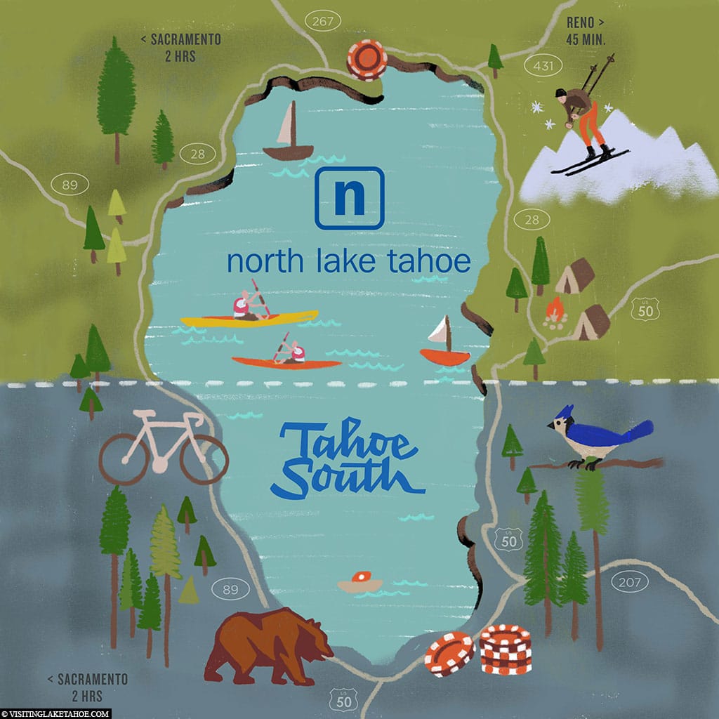
A map of Lake Tahoe in the USA
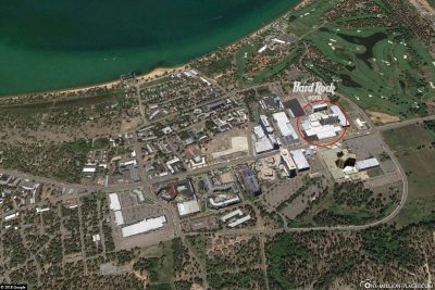
The Hard Rock Hotel & Casino Lake Tahoe
The state border between California and Nevada divides Lake Tahoe from north to south. Since gambling is only legal in the state of Nevada, all casinos around Lake Tahoe are on their eastern side. Since we definitely wanted to go to the casino during our stay, we had decided to go to a hotel with our own casino. Of course, you could have slept in any other hotel, but then you would have had to go to the casinos.
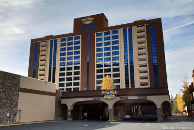
Our choice was hard Rock Hotel & Casino because of the good reviews on Tripadvisor and because it still had the best value for money among all casinos during our time of travel. Hard Rock Hotel is located in the Stateline area, just off the state border and minutes from the town of South Lake Tahoe. On US Highway 50, where the Hardrock Hotel is located, several large hotels & casinos are close together, so you can also do casino hopping here 🙂
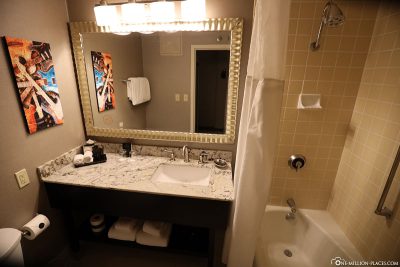
Hard Rock Hotel and Casino has more than 500 rooms, as well as several restaurants and bars. Our double room was very spacious and tastefully decorated. Here we felt totally comfortable. We had only a minimal view of the lake, but if you come back from sightseeing in the evening and are already outside at 7 o’clock in the morning, it wasn’t so important to us. In the evening we were in the hotel’s casino and played roulette and tried a few slot machines. We already know this from Las Vegas and always find the atmosphere in the American casinos totally cool. We could stand at the tables and vending machines for hours and just watch. We didn’t have luck in the game, but that’s not bad either. It’s much more interesting just to watch the people here. We’ve seen some people who started squeeking out of the slot machines because they had won a lot. Others played at two machines at the same time. Another sat at the roulette table with a huge stack of chips and five minutes later had nothing at all. Crazy world.
We paid a total of €198.78 Booking.com for a room (Value Room) for 2 nights on a weekend.

Our ride along the lake
A map with the photo spots at Lake Tahoe
Around 9 a.m. we set out to explore Lake Tahoe. Our path first led us along the Lincoln Higway on the eastern shore of the lake. On the following Google MyMaps map we have drawn the most famous photo spots on Lake Tahoe. You can also view the map here.
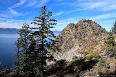
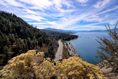
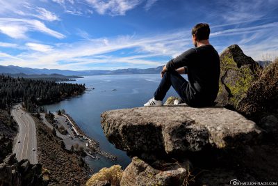
The magnificent view of the lake from Cave Rock
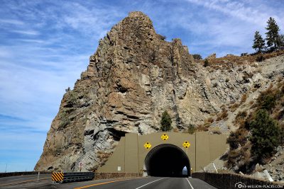
Our first port of call at the lake was Cave Rock, which is located on the southeast side of the lake.
Cave Rock is a 76-meter-high volcanic rock on U.S. Route 50 north of Stateline. The road passes through the Cave Rock Tunnel just below the rock. The rock formation was added to the National Register of Historic Places in 2017 as it is a traditional cultural asset of the local Washoe peoples.
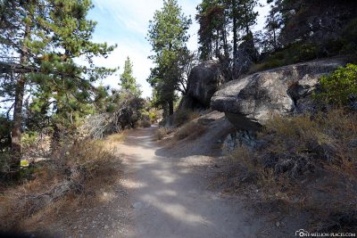
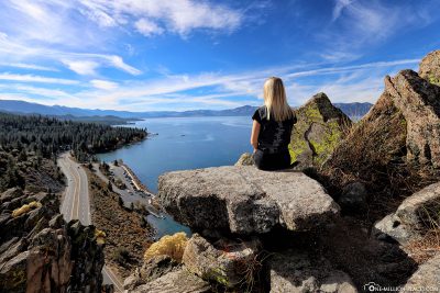
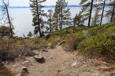
We turned right into Cave Rock Drive with our rental car just before the Cave Rock Tunnel. At the first large serpentine there are 4 parking spaces where you can park your car free of charge. Luckily, a car just drove away, so we had a great parking space right away. From here, the trail begins to Cave Rock, which runs above Highway 50. From the way you can already see the lake and the Cave Rock wonderfully. After a short time, the steep ascent to Cave Rock begins. But the Kraxelei is worth it, because upstairs you can expect a breathtaking view of Lake Tahoe. We were also really lucky with the weather: the sky was blue with a few little clouds and the sun shone like anything else. Normally the temperatures around this time are in the single digits here, but thanks to the intense sunlight, we could even walk in the T-shirt. How beautiful 🙂
With us there was another family on top of the rock, but they quickly went down again. From then on we were alone and could enjoy the view in peace, which was insanely beautiful. We really couldn’t see each other enough and took countless photos. You should definitely come here in the early morning at the latest, when there is not so much going on. We could imagine that it could get very crowded here from noon. The path is perhaps a total of 1.5 kilometres.
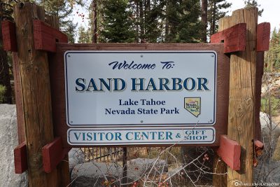
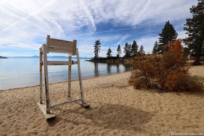
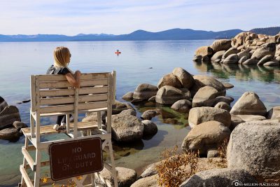
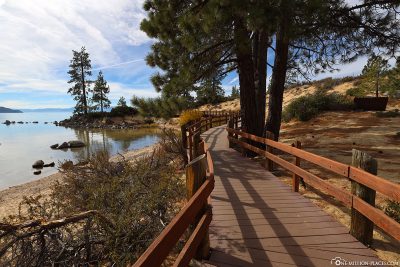
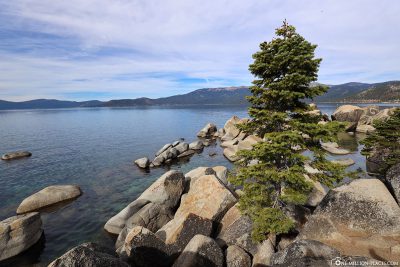
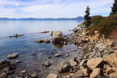
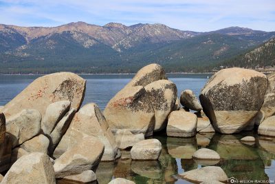
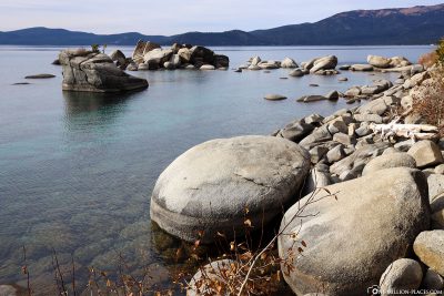
Sand Harbor in Lake Tahoe Nevada State Park
Sand Harbor in Lake Tahoe Nevada State Park is located on the northeastern shore of Lake Tahoe in Nevada. The park is open every day from 8 a.m. to 1 a.m. and costs USD 10 per car.
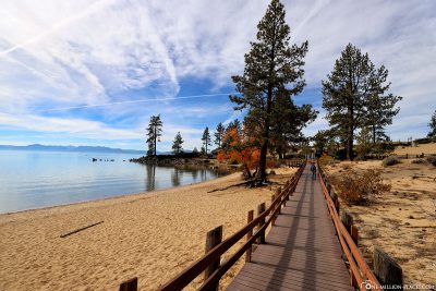
At the park entrance there is a small ranger’s house, where you usually have to pay your entrance fees. When we went into the park, the house was closed. In this case, you have to put the fees in a small labeled envelope and throw them into a box at the entrance. One section is then placed in the car “as proof” to show that the fees have been paid. When we drove into the parking lot, we also saw that a ranger had checked the cars already parked. The 10 USD are definitely worth it here and are well invested 😉
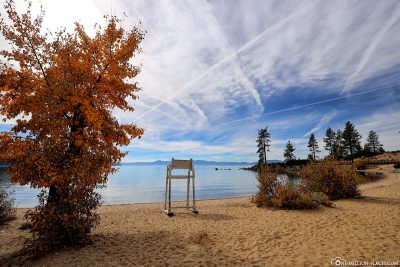
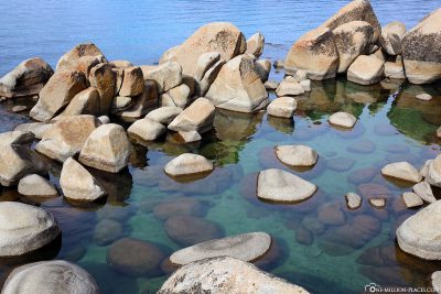
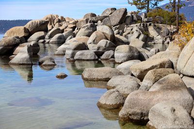
Sand Harbor is arguably the most popular beach park on Lake Tahoe. The park offers gently sloping beaches, crystal clear water, beautiful rock formations, picnic and barbecue areas, as well as the opportunity to engage in water sports activities such as canoeing. Autumn with its foliage has really shown itself at its most beautiful side. Fantastically beautiful. We were definitely in the park for two hours, walked around, took photos and just let our souls dangle.
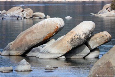
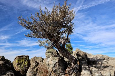
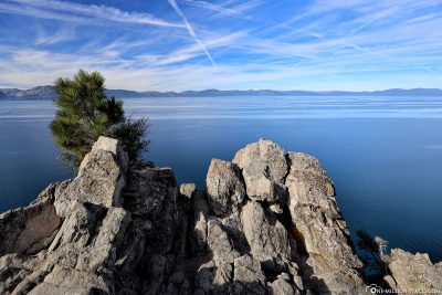
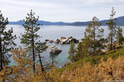
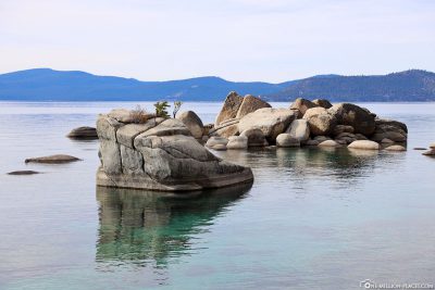
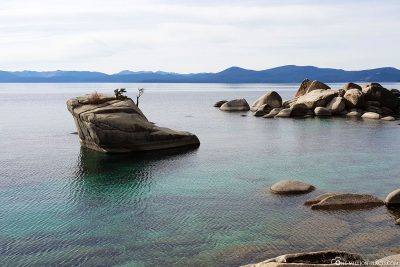
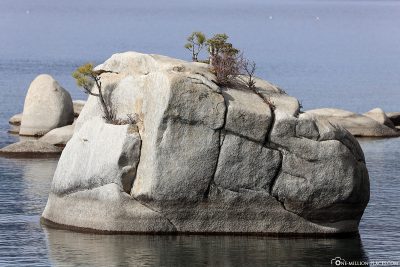
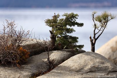
The Lonely Bonsai Rock
Bonsai Rock is a rock lying in the water with four small trees on it that grow from a crevice at the top of the rock. The rock is located about 1.5 kilometers south of Sand Harbor. The place where you can park on the road is not so easy to find, so you should not drive too fast. As a rule, there are always a few other cars there, so you can orientate yourself well after that.
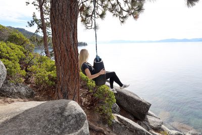
There are a few paths that lead down to the beach. The best way to take the sand path is very steep, but the shortest way. You should definitely wear closed shoes here; Flip-flops or sandals are not so practical. Once you have arrived at the bottom of the shore, you can see the Bonsai Rock already lying in the water. It’s nice to look at, but Sand Harbor has impressed us more overall than this rock here. Funny we found an old car tire, which is hung a little south as a swing on a tree 🙂
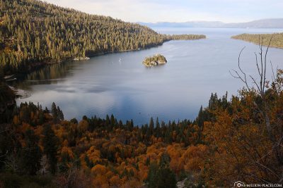
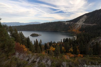
Der Emerald Bay State Park
In the afternoon we went to the other side of Lake Tahoe to see another highlight: Emerald Bay, which is located in the State Park of the same name.
From Inspiration Point, which is located on State Route 89, you can already catch a first glimpse of the bay. However, we find that you have a nicer view of the Bay if you drive a little further down the road and then – just before eagle falls – stop on the right by car and enjoy the view. Here, too, the foliage has already been beautifully coloured: a complete section of the forest on the bay was already colored orange. From here you can also see Fannette Island, a small island in the middle of Emerald Bay, which is also the only island in the whole of Lake Tahoe.
On the shores of the lake is Vikingsholm Castle, which has 38 rooms and is only accessible via a 1.5 kilometre long hiking trail. The building was built in 1928 for Lora Josephine Knight as a summer house in Scandinavian style. In summer (May to September) tours of the castle are offered regularly. Since it was already late in the afternoon and we would not have managed the hike in daylight, we unfortunately had to skip this stop.
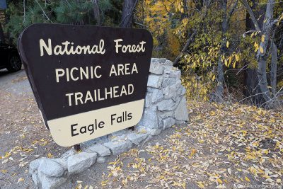
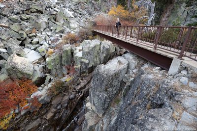
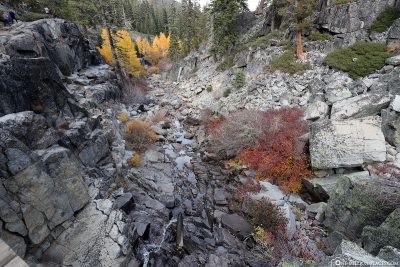
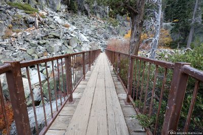
The Eagle Falls
Emerald Bay State Park also includes Eagle Falls, which are also located on California State Route 89. A short hiking trail leads from the parking lot directly to the two waterfalls, of which unfortunately nothing was visible at the end of October. There was simply no water at all and therefore no waterfalls. Really a pity. The Upper and Lower Eagle Falls are particularly worth seeing in spring, when the water masses of Eagle Creek fall cascading into the depths of Emerald Bay. We would have liked to have seen that.
Starbucks Global Icon City Mug from Lake Tahoe
We are collecting the Starbucks Mugs from the cities and islands we visit on our travels. Unfortunately, not every city that has a Starbucks store with an own mug. But if the city has an own mug we like to collect them as a souvenir. We only collect city mugs from the "Global Icon Series", which was released in 2008. You can see our complete collection here: Starbucks - Our collection of Mugs from the Global Icon SeriesLuckily, Lake Tahoe also has a nice Starbucks cup 🙂
The Starbucks City Cup from Lake Tahoe
All travelogues from California (2018)
For our 2 weeks in California we have put together a nice self-drive route, which includes city sightseeing as well as shopping and great nature. Our start is in San Francisco and from there we continue with a rental car to Sacramento and Lake Tahoe. Along the U.S. Highway 395 we drive over the 3,000 meter high Tioga Pass to Yosemite National Park before we head back towards the Pacific coast to Monterey Bay. The last part of the journey takes us along the Pacific Coast Highway (California State Route 1) to Los Angeles. All in all a nice route (see Google Maps) with a total length of about 1.500 kilometers 🙂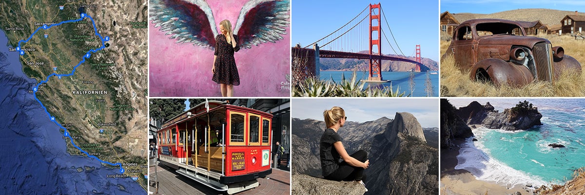 » San Francisco: 2 weeks in California – Travel planning & our flight with WOW air
» San Francisco: Tourist Attractions, Things to do & Photo spots
» San Francisco: Golden Gate Bridge in San Francisco – Things to know & Photo spots
» San Francisco: Alcatraz – Our travel guide for the prison island in San Francisco
» San Francisco: Muir Woods – A visit of the Coastal Sequoia Trees in California
» San Francisco: Cable Car – Travel Guide for the famous tram in San Francisco
» Sacramento: Tourist Attractions & Things to do in the Old Town
» Lake Tahoe: Tourist Attractions & the most beautiful photo spots
» Bodie Town: The most beautiful ghost town in California
» Yosemite Nationalpark: Things to know & Tioga Pass
» Yosemite Nationalpark: Mariposa Grove & the Grizzly Giant
» Yosemite Nationalpark: Glacier Point & the Yosemite Valley
» Monterey Bay: Whale Watching with Discovery Whale Watch
» Monterey Bay: The Monterey Bay Aquarium in Cannery Row
» Monterey Bay: 17-Mile Drive – Travel Guide, Things to Do & beautiful photo spots
» Highway 1: The Scenic drive between Monterey and Los Angeles
» Highway 1: Hearst Castle – The castle on the Pacific Coast Highway
» Los Angeles: 3 famous Instagram photo spots in Los Angeles